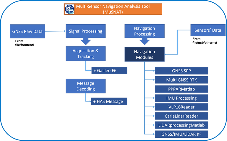
We seek to understand how information from multiple sensors can be combined best in the fields of geodesy and navigation in an optimal way. The institute accesses a broad variety of different sensors, e.g. LiDARs, RADARs, IMUs, GNSS receivers, cameras, and tachymeters to develop and improve specific Position Navigation Timing (PNT) solutions for future mass market as well as Safety of Life applications.
ISTA Bus
Projects:
- RAMBO
- Ghosthunter
- NavEn
- RA_PNZ
- MultiRAIM II
- OPA3L