Publikationen Univ.-Prof. Dr.-Ing. Wolfgang Reinhardt
Publikationen
Univ.-Prof. Dr.-Ing. Wolfgang REINHARDT
Jahre der Veröffentlichungen
| 2019 | 2018 | 2017 | 2016 | 2015 | 2014 | 2013 | 2012 | 2011 | 2010 |
| 2009 | 2008 | 2007 | 2006 | 2005 | 2004 | 2003 | 2002 | 2001 | 2000 |
| 1999 | 1998 | 1997 | 1996 | 1995 | 1994 | 1993 | 1992 | 1991 | 1990 |
| 1989 | 1988 | 1987 | 1986 | 1985 | 1984 |
2019
- REINHARDT, Wolfgang [2019]:
Qualitätssicherungs bei der Aktualisierung von Daten in Natzinformationssystemen
In: HANKE, Klaus / WEINOLD, Thomas (Hrsg.): 20. Internationale Geodätische Woche Obergurgl 2019. Wichmann Verlag, Berlin, S. 297-300
ISBN: 978-3-87907-659-8
e-ISBN: 978-3-87907-668-0
2018
- TAMPUBOLON, Winhard / REINHARDT, Wolfgang [2018]:
Quality Assessment of an Extended Interferometric Radar Data Processing Approach
In: ZLATANOVA, Sisi / DRAGICEVIC, Suzana / SITHOLE, George (Hrsg.): ISPRS TC IV Mid-term Symposium "3D Spatial Information Science - The Engine of Change", 1-5 October 2018, Delft, The Netherlands. The International Archives of the Photogrammetry, Remote Sensing and Spatial Information Sciences, Vol. XLII-4, S. 615-621
ISSN: 2194-9034 Download
2017
- REINHARDT, Wolfgang [2017]:
Weitere Entwicklungen von Qualitätssicherungsmaßnahmen in der Netzdokumentation
In: DEUTSCHER VEREIN DES GAS- UND WASSERFACHES (DVGW) (Hrsg.): Qualitätssicherung in der Netzdokumentation. DVGW-Seminar, 5. Dezember 2017, Bonn. DVGW Merkblatt GW 130, Seminarunterlagen - REINHARDT, Wolfgang / HOSSAIN, Md Imran [2017]:
Nutzung eines Body of Knowledge für das Curriculum Design
In: KERSTEN, Thomas P. (Hrsg.): Kulturelles Erbe erfassen und bewahren - Von der Dokumentation zum virtuellen Rundgang. 37. Wissenschaftlich-technische Jahrestagung der DGPF, 8.-10. März 2017 in Würzburg. Publikationen der Deutschen Gesellschaft für Photogrammetrie, Fernerkundung und Geoinformation e.V., Band 26, S. 342-349
ISSN: 0942-2870 Download
- TAMPUBOLON, Winhard / REINHARDT, Wolfgang [2017]:
Quality Assessment of an Extended Interferometric Radar Data Processing Approach
Abstract in: HALOUNOVÁ, Lena (Hrsg.): 37th EARSeL Symposium "Smart Future with Remote Sensing", Abstract Book, Czech Technical University in Prague, 27-30 June 2017. Published for EARSeL - European Association of Remote Sensing Laboratories, S. 73
ISBN: 978-80-01-06192-3 Download Abstract Download Poster
2016
- HOSSAIN, Md Imran / REINHARDT, Wolfgang [2016]:
An ArcGIS Tool for Creating Equitable Regions
In: 2016 Esri User Conference Proceedings, San Diego, June 27-30, 2016, 19 S. Download - REINHARDT, Wolfgang / HOSSAIN, Md Imran [2016]:
Using a GIS S&T Body of Knowledge within a Developed Curriculum Design Tool
In: 2016 Esri Education GIS Conference Proceedings, San Diego, June 27-30, 2016, 11 S. Download - TAMPUBOLON, Winhard / REINHARDT, Wolfgang [2016]:
Direct Georeferencing of UAV Data Based on Simple Building Structures
In: HALOUNOVA, Lena / ŠAFÁŘ, Václav / TOTH, Charles K. / KARAS, Ismael R. / HUADONG, Guo / HAALA, Norbert / HABIB, Ayman / REINARTZ, Peter / TANG, Xi / LI, J. / ARMENAKIS, C. / GRENZDÖRFFER, G. / LE ROUX, P. / STYLIANIDES, S. / BLASI, R. / MENARD, M. / DUFOURMOUNT, H. / LI, Z. (Hrsg.): The International Archives of the Photogrammetry, Remote Sensing and Spatial Information Sciences, Vol. XLI-B1, XXIII ISPRS Congress, Prague, Czech Republic, Commission I. S. 1043-1050. doi: 10.5194/isprs-archives-XLI-B1-1043-2016
ISSN: 1682-1750 [Druck]
ISSN: 1682-1777 [CD-ROM]
ISSN: 2194-9034 [Internet und USB] Download
2015
- HOSSAIN, Md Imran / REINHARDT, Wolfgang [2015]:
Road Network Segmentation for Bus-based Evacuation
In: BACAO, Fernando / SANTOS, Maribel Yasmina / PAINHO, Marco (Hrsg.): Proceedings 2015. The 18th AGILE International Conference on Geographic Information Science, Lisbon, 9-12 June 2015. Geographic Information Science as an Enabler of Smarter Cities and Communities. Short paper 93, 5 S.
ISBN: 978-3-319-16787-9 Download - SCHMID, Stephan / REINHARDT, Wolfgang [2015]:
Towards a General Evaluation Procedure for Geo Web Services
In: ROBBI SLUTER, Claudia / MADUREIRA CRUZ, Carla Bernadete / LEAL DE MENEZES, Paulo Márcio (Hrsg.): Cartography - Maps Connecting the World. 27th International Cartographic Conference - ICC2015. Lecture Notes in Geoinformation and Cartography, Subseries: Publications of the International Cartographic Association (ICA). Springer, Cham - Heidelberg - New York - Dordrecht - London, 15 S.
ISBN: 978-85-88783-11-9 Download - SCHMID, Stephan / GÁLICZ, Eszter / REINHARDT, Wolfgang [2015]:
WMS Performance of Selected SQL and NoSQL Databases
In: KRIVANEK, Vaclav (Hrsg.): Proceedings of the 2015 International Conference on Military Technologies (ICMT), Brno, 19 May - 21 May 2015. University of Defence, Brünn, S. 311-316
ISBN: 978-80-7231-976-3 Abstract
 - SCHMID, Stephan / GÁLICZ, Eszter / REINHARDT, Wolfgang [2015]:
Performance Investigation of Selected SQL and NoSQL Databases
In: BACAO, Fernando / SANTOS, Maribel Yasmina / PAINHO, Marco (Hrsg.): Proceedings 2015. The 18th AGILE International Conference on Geographic Information Science, Lisbon, 9-12 June 2015. Geographic Information Science as an Enabler of Smarter Cities and Communities. Short paper 68, 5 S.
ISBN: 978-3-319-16787-9 Download - TAMPUBOLON, Winhard / REINHARDT, Wolfgang [2015]:
UAV Data Processing for Rapid Mapping Activities
In: MALLET, C. / PAPARODITIS, N. / DOWMAN, I. / OUDE ELBERINK, S. / RAIMOND, A.-M. / SITHOLE, G. / RABATEL, G. / ROTTENSTEINER, F. / BRIOTTET, X. / CHRISTOPHE, S. / ÇÖLTEKIN, A. / PATANÈ, G. (Hrsg.): The International Archives of the Photogrammetry, Remote Sensing and Spatial Information Sciences, Vol. XL-3/W3, ISPRS Geospatial Week 2015, La Grande Motte, France. S. 371-377
ISSN: 1682-1750 [Druck]
ISSN: 1682-1777 [CD-ROM]
ISSN: 2194-9034 [Internet und USB] Download - TAMPUBOLON, Winhard / REINHARDT, Wolfgang [2015]:
Analysis of Radar and Optical Space Borne Data for Large Scale Topographical Mapping
In: STILLA, Uwe / HEIPKE, Christian (Hrsg.): PIA15, Photogrammetric Image Analysis + HRIGI15, High-Resolution Earth Imaging for Geospatial Information - Joint ISPRS Conference, 25-27 March 2015, Munich, Germany. International Archives of the Photogrammetry, Remote Sensing and Spatial Information Sciences, Vol. XL-3/W2. Technische Universität München, München, S. 235-242
ISSN: 1682-1750 [Druck]
ISSN: 1682-1777 [CD-ROM]
eISSN: 2194-9034 [Internet + USB] Download
2014
- HOSSAIN, Md Imran / REINHARDT, Wolfgang [2014]:
An Algorithm for Segmenting a Feature Set into Equitable Regions
In: HUERTA, Joaquín / SCHADE, Sven / GRANELL, Carlos (Hrsg.): Connecting a Digital Europe Through Location and Place. Selected best short papers and posters of the AGILE 2014 Conference, 03-06 June 2014, Castellón, Spain. AGILE Digital Editions, S. 55-59
ISBN: 978-90-816960-4-3 Download - REINHARDT, Wolfgang [2014]:
Geographic Information for Disaster Management – An Overview
In: TEODORESCU, Horia-Nicolai / KIRSCHENBAUM, Alan / COJOCARU, Svetlana / BRUDERLEIN, Claude (Hrsg.): Improving Disaster Resilience and Mitigation - IT Means and Tools. NATO Science for Peace and Security Series C: Environmental Security. Springer Netherlands, Dordrecht, Chapter 14, S. 225-238
ISBN: 978-94-017-9135-9
ISBN: 978-94-017-9136-6 - REINHARDT, Wolfgang [2014]:
Zur Bedeutung eines „Body of Knowledge“ für die Geoinformatik
In: SEYFERT, Eckhardt / GÜLCH, Eberhard / HEIPKE, Christian / SCHIEWE, Jochen / SESTER, Monika (Hrsg.): Geoinformationen öffnen das Tor zur Welt. 34. Wissenschaftlich-Technische Jahrestagung der DGPF, 62. Deutscher Kartographentag der DGfK, Geoinformatik 2014 der GfGI und des GIN, 26.–28. März 2014 in Hamburg. Publikationen der Deutschen Gesellschaft für Photogrammetrie, Fernerkung und Geoinformation, Band 23, Beitrag 133, 7 S.
ISSN: 0942-2870 Download - STRIEGL, Philipp / MÖNCH, Kim / REINHARDT, Wolfgang [2014]:
Untersuchungen zur Verbesserung der Aufnahmegenauigkeit von Abwasserleitungen
In: Zeitschrift für Geodäsie, Geoinformation und Landmanagement (zfv), 139. Jhrg., Heft 2, S. 71-80
ISSN: 1618-8950 Download - TAMPUBOLON, Winhard / REINHARDT, Wolfgang [2014]:
Automatic Large Scale Topographical Map Updating Using Open Street Map (OSM) Data Within NoSQL Database Platform
In: BEHR, Franz-Josef / PRADEEPKUMAR, A. P. (Hrsg.): Continuous Geospatial Education. Applied Geoinformatics for Society and Environment, AGSE 2014. 7th Alumni Summer School and Conference, November, 5-7, 2014, Stuttgart, Germany. Publications of Stuttgart University of Applied Sciences, No. 139. Hochschule für Technik Stuttgart, Stuttgart, S. 1-7
ISBN: 978-3-940670-49-6 Download - TAMPUBOLON, Winhard / REINHARDT, Wolfgang [2014]:
UAV Data Processing for Large Scale Topographical Mapping
In: REMONDINO, Fabio / MENNA, Fabio (Hrsg.): ISPRS Technical Commission V Symposium, June, 23-25, 2014, Riva del Garda, Italy. The International Archives of the Photogrammetry, Remote Sensing and Spatial Information Sciences, Vol. XL-5, S. 565-572
ISSN: 1682-1750 [Druck]
ISSN: 1682-1777 [CD-ROM]
eISSN: 2194-9034 [Internet + USB] Download
2013
- GÁLICZ, Eszter / HOSSAIN, Md Imran / REINHARDT, Wolfgang [2013]:
Geo Web Services for Transport Crisis Management in Alpine Region
In: BUCHROITHNER, Manfred F. / PRECHTEL, Nikolas / BURGHARDT, Dirk / PIPPIG, Karsten / SCHRÖTER, Benjamin (Hrsg.): From Pole to Pole. Proceedings of the 26th International Cartographic Conference, Dresden, Germany, 25–30 August 2013. Internationale Kartographische Vereinigung (IKV) / Deutsche Gesellschaft für Kartographie (DGfK), Dresden, 14 S.
ISBN: 978-1-907075-06-3 Download - REINHARDT, Wolfgang / BOCKMÜHL, Thorsten [2013]:
Continuous Improvement of Geographic Data Production Processes -
Approach and Results of a Case Study
In: MARCA, David / VAN SINDEREN, Marten (Hrsg.): ICE-B 2013, 10th International Conference on e-Business, Proceedings, Reykjavík, Iceland, 29-31 July, 2013. 7 S.
ISBN: 978-989-758-128-1 Abstract - REINHARDT, Wolfgang / BOCKMÜHL, Thorsten [2013]:
Prozessorientiertes Qualitätsmanagement bei der Aktualisierung von GIS/NIS-Daten -
Hintergrund und Ergebnisse einer Praxisstudie
In: Zeitschrift für Geodäsie, Geoinformation und Landmanagement (zfv), 138. Jhrg., Heft 1, S. 95-102
ISSN: 1618-8950 Download - REINHARDT, Wolfgang / GÁLICZ, Eszter / HOSSAIN, Md Imran [2013]:
Geo Web Services im Bereich des Katastrophenmanagements
In: UMWELTBUNDESAMT (Hrsg.): Umweltinformationssysteme. Wege zu Open Data - Mobile Dienste und Apps. 20. Workshop des Arbeitskreises „Umweltinformationssysteme“ der Fachgruppe „Informatik im Umweltschutz“, veranstaltet an der Hochschule für Technik und Wirtschaft in Berlin in Zusammenarbeit mit dem Umweltbundesamt am 23. und 24. Mai 2013. Freigegebene Vorträge, do03, 24 S. Download - REINHARDT, Wolfgang / GÁLICZ, Eszter / HOSSAIN, Md Imran [2013]:
Klassifizierung von GIS-Funktionalitäten im Bereich des Katastrophenmanagements
In: HANKE, Klaus / WEINOLD, Thomas (Hrsg.): 17. Internationale geodätische Woche Obergurgl 2013. Wichmann Verlag, Berlin, S. 173-182
ISBN: 978-3-87907-526-3 Download - SCHMID, Stephan / REINHARDT, Wolfgang [2013]:
Quality of Geo Web Services
In: Proceedings of the ICMT 13 - International Conference on Military Technologies. Brno, University of Defence, 2013
ISBN: 978-80-7231-918-3
2012
- HOSSAIN, Md Imran / REINHARDT, Wolfgang [2012]:
Curriculum Design Based on the UCGIS S&T Body of Knowledge Supported by a Software Tool
In: HUBEAU, Marianne / DE BAKKER, Marinus / TOPPEN, Fred / REINHARDT, Wolfgang / STEENBERGHEN, Thérèse / VAN ORSHOVEN, Jos (Hrsg.): 8th European GIS Education Seminar, 6-9 September, 2012. GIS-education: Where are the boundaries? Seminar Proceedings. Katholieke Universiteit Leuven, S. 19-26
ISBN: 978-90-8826-258-6 Download
|
 |
- NUHN, Eva / HASKE, Benjamin / REINHARDT, Wolfgang [2012]:
Generation of Landmarks from 3D City Models and OSM Data
In: GENSEL, Jérôme / JOSSELIN, Didier / VANDENBROUCKE, Danny (Hrsg.): Multidisciplinary Research on Geographical Information in Europe and Beyond. Proceedings of the AGILE'2012 International Conference on Geographic Information Science, Avignon, April, 24-27, 2012. S. 365/392-369/392
ISBN: 978-90-81960-0-5 Download - NUHN, Eva / KROPAT, Erik / REINHARDT, Wolfgang / PICKL, Stefan [2012]:
Preparation of Complex Landslide Simulation Results with Clustering Approaches for Decision Support and Early Warning
In: SPRAGHE, Ralph H. Jr. (Hrsg.): Proceedings of the Forthy-Fifth Annual Hawaii International Conference on System Sciences (HICSS), 4-7 January 2012, Maui, Hawaii. IEEE Computer Society Order Number P4525, S. 1089-1096
ISBN: 978-0-7695-4525-7 Download - REINHARDT, Wolfgang [2012]:
Zur Qualität und Usability von Geo Web Services
In: BEINEKE, Dieter / HEUNECKE, Otto / HORST, Thomas / KLEIM, Uwe G. F. (Hrsg.): Festschrift für Univ.-Prof. Dr.-Ing. Kurt Brunner anlässlich des Ausscheidens aus dem aktiven Dienst. Schriftenreihe des Instituts für Geodäsie der Universität der Bundeswehr München, Heft 87, S. 189-196
ISSN: 0173-1009 Download - REINHARDT, Wolfgang [2012]:
Statement of Usage of BoK in Our Institute
In: AGILE'2012 International Conference on Geographic Information Science, Avignon, April, 24-27, 2012, Preconference workshop "Views on the Body of Knowledge". 2 S. Download - REINHARDT, Wolfgang [2012]:
Buchbesprechung "Handbook of Geographic Information"
In: Zeitschrift für Geodäsie, Geoinformation und Landmanagement (zfv), 137. Jhrg., Heft 5, S. 333-334
ISSN: 1618-8950 - STRIEGL, Philipp / KANDAWASVIKA, Admire / REINHARDT, Wolfgang / HEISTER, Hansbert / HÜMMER, Frank [2012]:
Multi-sensor based Surveying of House Drainage System -
The current state of the art
In: 2012 International Conference on Indoor Positioning and Indoor Navigation (IPIN 2012). Proceedings of a meeting held 13-15 November 2012, Sydney, Australia. 4 S. Download
2011
- AMRHEIN, M. / DONAT, Hermann / MÖRTEL, H. / RADTKE, L. / REINHARDT, Wolfgang [2011]:
Arbeitspapier 3D-Volumenmodellierung in Straßenbauprozessen
FGSV Arbeitspapier 264. Forschungsgesellschaft für Straßen- und Verkehrswesen, Arbeitsgruppe Straßenentwurf. FGSV-Verlag, Köln, 12 S.
ISBN: 978-3-941790-97-1 - NUHN, Eva / REINHARDT, Wolfgang [2011]:
Coupling Geoinformation and Simulation Systems for the Early Warning of Landslides
In: Applied Geomatics, Vol. 3, Issue 2. Gi4DM: Geo-information for Disaster Management, Torino, Italy, February 2010, Part 1, S. 101-107
ISSN: 1866-9298 [Druck]
ISSN: 1866-928X [Online] Download - REINHARDT, Wolfgang [2011]:
Geoinformatics Education in Different Disciplines -
Challenges, Approaches and Experiences
In: HUBEAU, Marianne / STEENBERGHEN, Thérèse / VAN BALEN, Koen / VAN ORSHOVEN, Jos / VILEIKIS, Ona (Hrsg.): LeGIO-Workshop, 18th of November, 2011. GIS-education in a changing academic enwironment. Workshop Proceedings. Katholieke Universiteit Leuven, S. 21-28
ISBN: 978-90-8826-217-3 Download
|
 |
- SCHMID, Stephan / REINHARDT, Wolfgang [2011]:
Concept and Goals of a Geo Web Service Test Bed
In: Proceedings of the ICMT'11 - International Conference on Military Technologies, Brno, University of Defense, 2011
ISBN: 978-80-7231-787-5
2010
- BOCKMÜHL, Thorsten / MÄS, Stephan / REINHARDT, Wolfgang [2010]:
An Approach for Automatic Generation of Metadata Based on Data Product Specifications
In: Proceedings of INSPIRE Conference, 22-25 June 2010, Kraków, 13 S. Download - KONEČNÝ, Milan. / REINHARDT, Wolfgang (Gast-Editoren) [2010]:
Special Issue: Early warning and disaster management: the importance of geographic information (Part B)
International Journal of Digital Earth, Vol. 3, Issue 4, S. 313-ebi
ISSN: 1753-8947 [Druck]
ISSN: 1753-8955 [Online] - KONEČNÝ, Milan. / REINHARDT, Wolfgang [2010]:
Editorial
In: KONEČNÝ, Milan. / REINHARDT, Wolfgang (Gast-Editoren) [2010]: Special Issue: Early warning and disaster management: the importance of geographic information (Part B). International Journal of Digital Earth, Vol. 3, Issue 4, S. 313-315
ISSN: 1753-8947 [Druck]
ISSN: 1753-8955 [Online] - KONEČNÝ, Milan. / REINHARDT, Wolfgang (Gast-Editoren) [2010]:
Special Issue: Early warning and disaster management: the importance of geographic information (Part A)
International Journal of Digital Earth, Vol. 3, Issue 3, S. 217-311
ISSN: 1753-8947 [Druck]
ISSN: 1753-8955 [Online] - KONEČNÝ, Milan. / REINHARDT, Wolfgang [2010]:
Editorial
In: KONEČNÝ, Milan. / REINHARDT, Wolfgang (Gast-Editoren) [2010]: Special Issue: Early warning and disaster management: the importance of geographic information (Part A). International Journal of Digital Earth, Vol. 3, Issue 3, S. 217-220
ISSN: 1753-8947 [Druck]
ISSN: 1753-8955 [Online] - NUHN, Eva / REINHARDT, Wolfgang [2010]:
Overview of a Coupled Geoinformation and Simulation System for the Early Warning of Landslides
In: 6th GI4DM Conference on Geomatics for Crisis Management, Turino, February 2-4, 2010. Proceedings (DVD). Download - NUHN, Eva / REINHARDT, Wolfgang [2011]:
Coupling Geoinformation and Simulation Systems for the Early Warning of Landslides
In: Applied Geomatics, Vol. 3, Issue 2. Gi4DM: Geo-information for Disaster Management, Torino, Italy, February 2010, Part 1, S. 101-107
ISSN: 1866-9298 [Druck]
ISSN: 1866-928X [Online] Download - ORTLIEB, Eva / REINHARDT, Wolfgang / TRAUNER, Franz-Xaver [2010]:
Development of a Coupled Geoinformation and Simulation System for Early Warning
In: KONEČNÝ, Milan / ZLATANOVA, Sisi / BANDROVA, Temenoujka L. (Hrsg.): Geographic Information and Cartography for Risk and Crisis Management. Towards Better Solutions. Lecture Notes in Geoinformation and Cartography (LNG&C), Springer-Verlag, Berlin/Heidelberg, S. 273-286
ISBN: 978-3-642-03441-1 [Druck]
ISBN: 978-3-642-03442-8 [Online] Download
|
 |
- REINHARDT, Wolfgang [2010]:
Enterprise GIS
In: WARF, Barney (Hrsg.): Encyclopedia of Geography, Vol. 2. SAGE Publications Inc., Los Angeles, 3 S.
ISBN: 978-1-4129-5697-0 [Druck]
ISBN: 978-1-4129-3959-1 [Online] - STRIEGL, Philipp / HEISTER, Hansbert / KANDAWASVIKA, Admire / REINHARDT, Wolfgang / RENTER, Jörg [2010]:
Multisensorsystem geoASYS zur 3D Kanaldokumentation
In: WUNDERLICH, Thomas A. (Hrsg.): Ingenieurvermessung 10. Beiträge zum 16. Internationalen Ingenieurvermessungskurs, München, 2010. Wichmann Verlag, Berlin, S. 145-156
ISBN: 978-3-87907-492-1 Download
2009
- BAUER, Arno / HEISTER, Hansbert / REINHARDT, Wolfgang [2009]:
geoAsys - ein System zur Dokumentation des Verlaufes von Grundstücksentwässerungsanlagen
In: gwf Wasser Abwasser, 150. Jhrg., Heft 2-3/2009, 7 S.
ISSN: 0016-3651 - BOCKMÜHL, Thorsten / REINHARDT, Wolfgang [2009]:
Forschungsergebnisse werden Regelwerk
In: energie | wasser-praxis, Heft 5/2009
ISSN: 1436-6134 - BOCKMÜHL, Thorsten / REINHARDT, Wolfgang / SPLETTSTÖSSER, Wolf [2009]:
GIS-gestützte Ermittlung des Gefährdungspotentials von Tularämie in Deutschland
In: REINHARDT, Wolfgang / KRÜGER, Antonio / EHLERS, Manfred (Hrsg.): Geoinformatik 2009. 31. März - 02. April 2009, Osnabrück. Konferenzband. ifgi-Prints, Schriftenreihe des Instituts für Geoinformatik, Westfälische Wilhelms-Universität Münster, Band 35, S. 77-84
ISBN: 978-3-89838-619-7 - BREUNIG, Martin / REINHARDT, Wolfgang / BOLEY, Conrad / WIESEL, Joachim / ABECKER, Andreas / KAZAKOS, Wassilios [2009]:
Development of Suitable Information Systems for Early Warning Systems (EGIFF)
In: REINHARDT, Wolfgang / KRÜGER, Antonio / EHLERS, Manfred (Hrsg.):
Geoinformatik 2009. 31. März - 02. April 2009, Osnabrück. Konferenzband. ifgi-Prints, Schriftenreihe des Instituts für Geoinformatik, Westfälische Wilhelms-Universität Münster, Band 35, S. 247-250
ISBN: 978-3-89838-619-7 - BREUNIG, Martin / SCHILBERG, Björn / KUPER, Paul Vincent / JAHN, Markus / REINHARDT, Wolfgang / NUHN, Eva / MÄS, Stephan / BOLEY, Conrad / TRAUNER, Franz-Xaver / WIESEL, Joachim / RICHTER, Daniela / ABECKER, Andreas / GALLUS, Dominik / KAZAKOS, Wassilios / BARTELS, Andreas [2009]:
EGIFF - Developing Advanced GI Methods for Early Warning in Mass Movement Scenarios
In: GEOTECHNOLOGIEN Science Report No. 13, Early Warning Systems in Earth Management, Status Seminar 12-13 October 2009, Technische Universität München, Programme & Abstracts, S. 49-72
ISSN: 1619-7399 Download - BREUNIG, Martin / SCHILBERG, Björn / JAHN, Markus / KUPER, Paul Vincent / REINHARDT, Wolfgang / ORTLIEB, Eva / BOLEY, Conrad / TRAUNER, Franz-Xaver / WIESEL, Joachim / RICHTER, Daniela / SCHUFFERT, Simon / ABECKER, Andreas / GALLUS, Dominik / KAZAKOS, Wassilios / BARTELS, Andreas [2009]:
GI Methodenentwicklung zur Unterstützung der Analyse und Frühwarnung von Massenbewegungen
In: REINHARDT, Wolfgang / KRÜGER, Antonio / EHLERS, Manfred (Hrsg.): Geoinformatik 2009. 31. März - 02. April 2009, Osnabrück. Konferenzband. ifgi-Prints, Schriftenreihe des Instituts für Geoinformatik, Westfälische Wilhelms-Universität Münster, Band 35, S. 269-274
ISBN: 978-3-89838-619-7 - MÄS, Stephan / REINHARDT, Wolfgang [2009]:
Categories of Geospatial and Temporal Integrity Constraints
In: DRAGICEVIC, Suzana / ROMAN, Dumitru / TANASESCU, Vlad (Hrsg.): Proceedings. The International Conference on Advanced Geographic Information Systems & Web Services, GEOWS 2009, 1-7 February 2009, Cancun, Mexico. IEEE Computer Society Order Number E3527, Los Alamito/Washington/Tokyo, S. 146-151
ISBN: 978-1-4244-3363-6 [Druck]
ISBN: 978-0-7695-3527-2 [Online] Download - ORTLIEB, Eva / REINHARDT, Wolfgang / TRAUNER, Franz-Xaver [2009]:
Kopplung von Geoinformations- und Simulationssystemen zur Entscheidungsunterstützung
In: Arbeitsgruppe Automation in Kartographie, Photogrammetrie und GIS - Tagung 2008. Mitteilungen des Bundesamtes für Kartographie und Geodäsie, Band 43. Verlag des Bundesamtes für Kartographie und Geodäsie, Frankfurt am Main, S. 97-106
ISBN: 978-3-89888-955-1 Download - ORTLIEB, Eva / REINHARDT, Wolfgang / TRAUNER, Franz-Xaver [2009]:
Development of a Coupled Geo Information and Simulation System for Early Warning Systems
In: KONEČNÝ, Milan / ZLATANOVA, Sisi / BANDROVA, Temenoujka / FRIEDMANNOVA, Lucie (Hrsg.): Cartography and Geoinformatics for Early Warning and Emergency Management: Towards better Solutions, January, 19-22, 2009, Prague, Czech Republic. Joint Symposium of ICA Working Group on CEWaCM and JBGIS Gi4DM. Abstracts. Masaryk Universität, Brünn, S. 27 Download - REINHARDT, Wolfgang [2009]:
Some Thoughts on the Usage of a Body of Knowledge (BoK) in GI Education
In: Proceedings of the 24th International Cartographic Conference, Santiago de Chile, 15–21 November, 2009. Non-Referred Papers, Theme 18: Education, Paper 9, 6 S. Download - REINHARDT, Wolfgang [2009]:
Aktuelle Entwicklungen in der GIS-Technologie
In: JT-ELEKTRONIK (Hrsg.): 22. Lindauer Seminar "Praktische Kanalisationstechnik - Instandhaltung von Kanalisationen", Lindau, 05/06.03.2009, Tagungsband - REINHARDT, Wolfgang / BOCKMÜHL, Thorsten / HEISTER, Hansbert / KANDAWASVIKA, Admire / RENTER, Jörg [2009]:
Aktueller Stand der Erfassung von Grundstückentwässerungsanlagen
In: DEUTSCHE VEREINIGUNG FÜR WASSERWIRTSCHAFT, ABWASSER UND ABFALL (Hrsg.): 6. DWA-Tagung "GIS in der Wasserwirtschaft", Kassel, 21/22.01.2009. Tagungsband auf CD-ROM
|
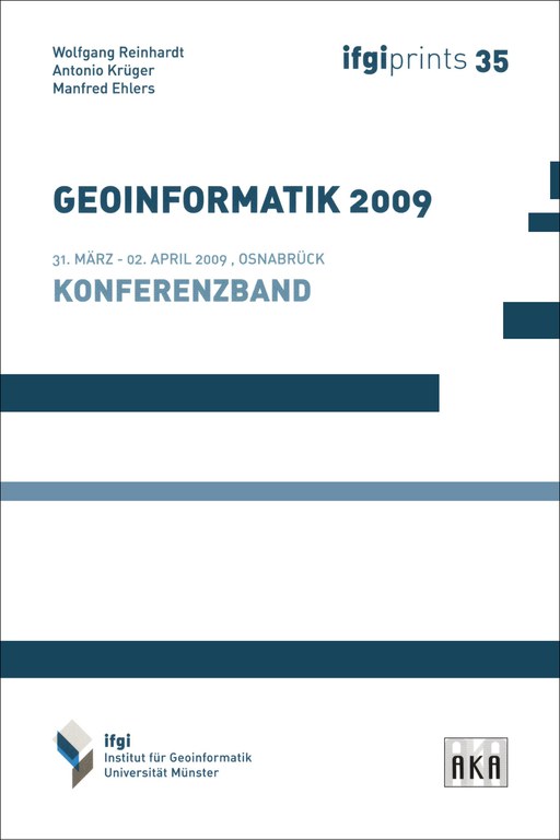 |
- WIEBROCK, Iris / REINHARDT, Wolfgang [2009]:
Context-aware Visualization on the Web
In: Proceedings of the 24th International Cartographic Conference, Santiago de Chile, 15–21 November, 2009. Non-Referred Papers, Theme 13: Internet, Paper 13, 8 S. Download
2008
- BERNHARD, Lars / REINHARDT, Wolfgang [2008]:
AGILE - Association of Geographic Information Laboratories for Europe
In: GIS - Zeitschrift für Geoinformatik, Heft 3/2008
ISSN: 1869-9391 - BOCKMÜHL, Thorsten / REINHARDT, Wolfgang [2008]:
Leitfaden zur Entwicklung eines prozessorientierten Qualitätsmanagements für die Produktion von Netzinformationen in Versorgungsunternehmen
FQS-DGQ-Band 83-04, herausgegeben von der Forschungsgemeinschaft Qualität e.V. (FQS), Frankfurt am Main, 98 S. + 1 CD-ROM
ISBN: 978-3-940991-00-3 - BOCKMÜHL, Thorsten / REINHARDT, Wolfgang [2008]:
Qualitätsbewusstsein in der Produktion von Netzinformationen
In: PPS - Management, 13. Jhrg., Heft 1, S. 47-50
ISSN: 1434-2308 - BOCKMÜHL, Thorsten / REINHARDT, Wolfgang [2008]:
Prozessorientiertes Qualitätsmanagement für den Aktualisierungsprozess von Netzdaten
In: energie | wasser-praxis, Heft 2/2008
ISSN: 1436-6134 - BREUNIG, Martin / BROSCHEIT, Björn / REINHARDT, Wolfgang / ORTLIEB, Eva / MÄS, Stephan / BOLEY, Conrad / TRAUNER, Franz-Xaver / WIESEL, Joachim / RICHTER, Daniela / ABECKER, Andreas / GALLUS, Dominik / KAZAKOS, Wassilios / BARTELS, Andreas [2008]:
Towards an Information System for Early Warning of Landslides
In: MÖLLER, Andreas / PAGE, Bernd / SCHREIBER, Martin (Hrsg.): 2008 enviroinfo. Environmental Informatics and Industrial Ecology. Proceedings of the 22th International Conference on Information for Environmental Protection, September 10-12, 2008, Leuphana Universität Lüneburg. Shaker Verlag, Aachen, S. 476-481
ISBN: 978-3-8322-7313-2 - BREUNIG, Martin / BROSCHEIT, Björn / REINHARDT, Wolfgang / ORTLIEB, Eva / MÄS, Stephan / BOLEY, Conrad / TRAUNER, Franz-Xaver / WIESEL, Joachim / RICHTER, Daniela / ABECKER, Andreas / GALLUS, Dominik / KAZAKOS, Wassilios / BARTELS, Andreas [2008]:
Development of Suitable Information Systems for Early Warning Systems (EGIFF)
In: Early Warning Systems in Earth Management. Status-Seminar, October, 8-9, 2008, University Osnabrück, Abstracts. R&D Programme Geotechnologien. Universität Osnabrück, Osnabrück, S. 113-130 - ORTLIEB, Eva / MÄS, Stephan / REINHARDT, Wolfgang / TRAUNER, Franz-Xaver [2008]:
Coupling Simulations of Landslides with Geoinformation Systems for Decision Support and Early Warning
In: BERNARD, Lars / FRIIS-CHRISTENSEN, Anders / PUNDT, Hardy / COMPTE, Irene (Hrsg.): Proceedings 2008. The 11th AGILE International Conference on Geographic Information Science, Girona, Spain, 5-8 May, 2008. The European Information Society. Poster Abstracts, doc_83, 3 S.
ISBN: 978-3-540-78945-1 Download - REINHARDT, Wolfgang [2008]:
Current Issues in GI Quality Research
In: KONEČNÝ, Milan / BANDROVA, Temenoujka L. (Hrsg.): Proceedings 2: Second International Conference on Cartography and GIS, Borovets, Bulgaria, January 21-24, 2008. International Cartographic Association (ICA) / University of Architecture, Civil Engineering and Geodesy, Sofia
ISBN: 978-954-724-038-4 - REINHARDT, Wolfgang [2008]:
Early Warning Systems for Landslide Vulnerable Regions
In: GIM international, Volume 22, Issue 9
ISSN: 1566-9076 - REINHARDT, Wolfgang [2008]:
AGIS
In: GIM International, Vol. 22, Issue 6
ISSN: 1566-9076 - REINHARDT, Wolfgang [2008]:
How OGC membership supports the member's activities
In: GIM International, Vol. 22, Issue 6
ISSN: 1566-9076 - REINHARDT, Wolfgang [2008]:
Gedanken zur Geoinformatik (GI) – Ausbildung
In: arc aktuell, Heft 1/2008
ISSN: 1617-8394 - REINHARDT, Wolfgang / TOPPEN, Fred [2008]:
The UCGIS Geographic Information Science and Technology Body of Knowledge -
Some Thoughts from a European Perspective
In: Proceedings of the 5th International Conference on Geographic Information Science, Park City, UT, USA, September 23-26, 2008 - WIEBROCK, Iris / REINHARDT, Wolfgang [2008]:
A Context-Aware User Group Model for Web Portrayal Services
In: Proceedings of the 5th International Conference on Geographic Information Science, Park City, UT, USA, September 23-26, 2008, S. 325-330
2007
- BOCKMÜHL, Thorsten / REINHARDT, Wolfgang [2007]:
QM und Risiko in Netzinformationssystemen
In: Tagungsband zur FQS-Forschungstagung "Zukunft Qualität - Risiken beherrschen" 2007, FQS-Band 80-07. Forschungsgemeinschaft Qualität e.V., Frankfurt am Main, S. ?-47
ISSN: 0949-7439 - BOCKMÜHL, Thorsten / REINHARDT, Wolfgang [2007]:
Performance Measurement of Process-based Quality Management for GIS Updating Processes
In: WACHOWICZ, Monica / BODUM, Lars (Hrsg.): Proceedings 2007. The 10th AGILE International Conference on Geographic Information Science, Aalborg, Denmark. Poster Abstracts, 147_PDF, 7 S. Download - BREUNIG, Martin / REINHARDT, Wolfgang / ORTLIEB, Eva / MÄS, Stephan / BOLEY, Conrad / TRAUNER, Franz-Xaver / WIESEL, Joachim / RICHTER, Daniela / ABECKER, Andreas / GALLUS, Dominik / KAZAKOS, Wassilios [2007]:
Development of Suitable Information Systems for Early Warning Systems
In: GEOTECHNOLOGIEN Science Report No.10. Early Warning Systems in Earth Management - Kick-Off-Meeting, 10 October 2007, Technical University Karlsruhe, Programm & Abstracts, S. 113-123
ISSN: 1619-7399 Download - HEISTER, Hansbert / REINHARDT, Wolfgang [2007]:
3D-Dokumentation von Kanalanschlussleitungen - Ortung und Inspektion im Untergrund
In: CHESI, Günter / WEINOLD, Thomas (Hrgs.): 14. Internationale Geodätische Woche Obergurgl 2007. Wichmann Verlag, Heidelberg, S. 31-39
ISBN: 978-3-87907-446-4 - HEISTER, Hansbert / REINHARDT, Wolfgang / GÜNTHERT, F. Wolfgang / CVACI, Darius [2007]:
3D-Dokumentation von Anschlusskanälen und Grundstücksentwässerungsleitungen
In: KA - Abwasser, Abfall, 54. Jahrgang, Nr. 6, S. 584-588
ISSN: 1866-0029 - MÄS, Stephan / REINHARDT, Wolfgang [2007]:
Europaweiter Austausch von GI e-Learning Kursen:
ein Erfahrungsbericht
In: JEKEL, Thomas / KOLLER, Alfons / STROBL, Josef (Hrsg.): Lernen mit Geoinformation II. Wichmann Verlag, Heidelberg, S. 226-231
ISBN: 978-3-87907-460-0 - PÖTZSCH, Manuela / REINHARDT, Wolfgang [2007]:
Metadata Management - An Analysis from Creation till Use
In: PROBST, Florian / KESSLER, Carsten (Hrsg.): GI-Days 2007 - Young Researchers Forum. Proceedings of the 5th Geographic Information Days, 10.-12. September 2007, Münster, Germany. ifgi-Prints, Schriftenreihe des Instituts für Geoinformatik, Westfälische Wilhelms-Universität Münster, Band 30. Westfälische Wilhelms-Universität Münster, S. 267-270
ISBN: 978-3-936616-48-4 Download
|
 |
- REINHARDT, Wolfgang / BOCKMÜHL, Thorsten [2007]:
Qualität der Netze.
Balanced Scorecard überwacht prozessorientiertes QM
In: Qualität und Zuverlässigkeit (QZ), Heft 02/2007, S. 60-61
ISSN: 0720-1214 Download - REINHARDT, Wolfgang / KOTTHOFF, Christian [2007]:
Studieren in Athen ohne Neubiberg zu verlassen.
Erste Erfahrungen mit internationalen e-Learning-Kursen der Geoinformatik
In: Hochschulkurier, Universität der Bundeswehr München, Nr. 29, Juni 2007, S. 30-31
ISSN: 234-87643 Download - REINHARDT, Wolfgang / MÄS, Stephan [2007]:
Erfahrungen beim Austausch von e-Learning-Kursen auf europäischer Ebene
In: SEYFERT, Eckhardt (Hrsg.): Vorträge Dreiländertagung SGPBF, DGPF und OVG. 27. Wissenschaftlich-Technische Jahrestagung der DGPF, 19.-21. Juni 2007 in Muttenz, Basel. Von der Medizintechnik bis zur Planetenforschung - Photogrammetrie und Fernerkundung für das 21. Jahrhundert. Publikationen der Deutschen Gesellschaft für Photogrammetrie, Fernerkundung und Geoinformation e.V., Band 16, S. 51-57
ISSN: 0942-2870 Download - STROBEL, Stefan / REINHARDT, Wolfgang [2007]:
Die Bedeutung von Profilen für den Datenaustausch mittels Geography Markup Language
In: Arbeitsgruppe Automation in der Kartographie - Tagung 2006. Mitteilungen des Bundesamtes für Kartographie und Geodäsie, Band 39. Verlag des Bundesamtes für Kartographie und Geodäsie, Frankfurt am Main, S. 41-48
ISBN: 3-89888-824-X - STÜRMER, Simone / REINHARDT, Wolfgang [2007]:
Qualitätsmanagement von digitalen Netzinformationen bei Ent- und Versorgungsunternehmen (EVU)
In: Arbeitsgruppe Automation in der Kartographie - Tagung 2006. Mitteilungen des Bundesamtes für Kartographie und Geodäsie, Band 39. Verlag des Bundesamtes für Kartographie und Geodäsie, Frankfurt am Main, S. 49-68
ISBN: 3-89888-824-X - WACHOWICZ, Monica / GOULD, Michael / REINHARDT, Wolfgang [2007]:
AGILE: The Challenges on Advancing GI Education and Research in Europe
In: Revista IG+ - WANG, Fei / REINHARDT, Wolfgang [2007]:
Extending Geographic Data Modeling by Adopting Constraint Decision Table to Specify Spatial Integrity Constraints
In: FABRIKANT, Sara Irina / WACHOWICZ, Monica (Hrsg.): The European Information Society. Leading the Way with Geo-Information. 10th Conference of the Association of Geographic Information Laboratories for Europe (AGILE), held in Aalborg, Denmark. Lecture Notes in Geoinformation and Cartography (LNG&C). Springer Verlag, Berlin, S. 435-452
ISBN: 978-3-540-72384-4 - WIEBROCK, Iris / REINHARDT, Wolfgang [2007]:
A Web Service-Based and User Specific Portrayal for Geodata
In: PROBST, Florian / KESSLER, Carsten (Hrsg.): GI-Days 2007 - Young Researchers Forum. Proceedings of the 5th Geographic Information Days, 10.-12. September 2007, Münster, Germany. ifgi-Prints, Schriftenreihe des Instituts für Geoinformatik, Westfälische Wilhelms-Universität Münster, Band 30. Westfälische Wilhelms-Universität Münster, S. 147-164
ISBN: 978-3-936616-48-4 Download
2006
- BREUNIG, Martin / BÄR, Wolfgang / THOMSEN, Andreas / HÄUSSLER, Jochen / KIPFER, Anja / KANDAWASVIKA, Admire / MÄS, Stephan / REINHARDT, Wolfgang / WANG, Fei / BRANDT, Stephanie / STAUB, Guido / WIESEL, Joachim [2006]:
Advancement of Mobile Geoservices: Potential and Experiences
In: GEOTECHNOLOGIEN “Science Report” No. 8: Information Systems in Earth Management - From Science to Application. Results from the First Funding Period (2002-2005), S. 32-50
ISSN: 1619-7399 Download - MÄS, Stephan / REINHARDT, Wolfgang / WANG, Fei [2006]:
Conception of a 3D Geodata Web Service for the Support of Indoor Navigation with GNSS
In: ABDUL-RAHMAN, Alias / ZLATANOVA, Sisi / COORS, Volker (Hrsg.): Innovations in 3D Geoinformation Science. Lecture Notes in Geoinformation and Cartography (LNG&C). Springer Verlag, Berlin/Heidelberg/New York, S. 307-316
ISBN: 978-3-540-36997-4
|
 |
- WANG, Fei / REINHARDT, Wolfgang [2006]:
Spatial data quality concerns for field data collection in Mobile GIS
In: GONG, Jianya / ZHANG, Jingxiong (Hrsg.): Geoinformatics 2006: Geospatial Information Science, 28-29 October 2006, Wuhan, China. Proceedings SPIE Vol. 6420. Society of Photo-optical Instrumentation Engineers (SPIE), Bellingham, 7 S.
ISSN: 0038-7355
ISBN: 0-8194-6529-1 - WANG, Fei / REINHARDT, Wolfgang [2006]:
The integration of spatial integrity constraints in geographic data modeling
In: RAUBAL, Martin / MILLER, Harvey J. / FRANK, Andrew U. / Goodchild, Michael F. (Hrsg.): Geographic Information Science. Fourth International Conference, GIScience 2006, Münster, Germany, September 2006. Extended Abstracts. Ifgi-Prints, Schriftenreihe des Instituts für Geoinformatik, Westfälische Wilhelms-Universität Münster, Band 28, S. 395-398
ISSN: 2191-5237
2005
- BREUNIG, Martin / BÄR, Wolfgang / HÄUSSLER, Jochen / REINHARDT, Wolfgang / STAUB, Guido / WIESEL, Joachim [2005]:
Advancement of Mobile Spatial Services for the Geosciences
In: Data Science Journal, a journal of the Comittee on Data for Science and Technology (CODATA) of the International Council for Science (ICSU)
ISSN: 1683-1470 - KANDAWASVIKA, Admire / REINHARDT, Wolfgang [2005]:
Concept for Interoperable Usage of Multi-sensors within a Landslide Monitoring Application Scenario
In: Proceedings 2005. The 8th AGILE International Conference on Geographic Information Science, Visegrád, Hungary, 9 S. Download - KANDAWASVIKA, Admire / REINHARDT, Wolfgang [2005]:
Investigation on Multi-GeoSensors Integration using OGC SensorWeb in a Landslide Monitoring System
In: Proceedings GI-Days 2005: Geo-Sensor Networks - From Science to Practical Applications. ifgi-Prints, Schriftenreihe des Instituts für Geoinformatik, Westfälische Wilhelms-Universität Münster, Band 23 - KANDAWASVIKA, Admire / REINHARDT, Wolfgang / MÄS, Stephan / WANG, Fei [2005]:
Generic Mobile Data Acquisition System for Geosciences Applications
In: FREIWALD, André / RÖHLING, Heinz-Gerd / LÖFFLER, Sonja-B. (Hrsg.): GeoErlangen 2005. System Earth - Biosphere Coupling. Regional Geology of Central Europe. September 24-29, 2005. Program and Abstracts. Schriftenreihe der Deutschen Geologischen Gesellschaft, Heft 39. Deutsche Gesellschaft für Geowissenschaften, Hannover
ISBN: 3-932537-34-3 - MÄS, Stephan / REINHARDT, Wolfgang [2005]:
Standardisierte Internetdienste bei der mobilen GIS-Datenerfassung
In: Geomatik Schweiz, Geoinformation und Landmanagement, 103. Jhrg., Heft 12, S. 656-660
ISSN: 1660-4458 - MÄS, Stephan / REINHARDT, Wolfgang / KANDAWASVIKA, Admire / WANG, Fei [2005]:
Concepts for Quality Assurance During Mobile Online Data Acquisition
In: Proceedings 2005. The 8th AGILE International Conference on Geographic Information Science, Visegrád, Hungary, 10 S. Download - MÄS, Stephan / WANG, Fei / REINHARDT, Wolfgangg [2005]:
Using Ontologies for Integrity Constraint Definition
In: WU, L. / SHI, W. / FANG, Y. / TONG, Q. (Hrsg.): Proceedings of the 4th International Symposium on Spatial Data Quality, 25th to 26th August 2005, Beijing, China. The Hong Kong Polytechnic University
|
 |
- REINHARDT, Wolfgang [2005]:
Teaching GI Standards in Higher eEducation - Examples from Distance and Classroom Teaching
In: KONEČNÝ, Milan / LORENZO, Ramón M. / VÁSQUEZ, Francisco (Hrsg.): Proceedings of the International Cartographic Conference 2005, 9-16 July, A Coruña, Spain. Download - REINHARDT, Wolfgang / KANDAWASVIKA, Admire / MÄS, Stephan / WANG, Fei [2005]:
Mobile Geospatial Data Collection - Concepts and First Experiences
In: KONEČNÝ, Milan / LORENZO, Ramón M. / VÁSQUEZ, Francisco (Hrsg.): Proceedings of the International Cartographic Conference 2005, 9-16 July, A Coruña, Spain. 6 S. Download - WANG, Fei / MÄS, Stephan / REINHARDT, Wolfgang / KANDAWASVIKA, Admire [2005]:
Ontology Based Quality Assurance for Mobile Data Acquisition
In: HŘEBÍČEK, Jiří / RÁČEK, Jaroslv (Hrsg.): Informatics for Environmental Protection : Networking Environmental Information, EnviroInfo Brno, 2005. Proceedings of the 19th International Conference Informatics for Environmental Protection, September 7-9,2005, Masaryk University in Brno, Czech Republic.
ISBN: 80-210-3780-6 - WIEBROCK, Iris / REINHARDT, Wolfgang [2005]:
Präsentation von Karten im Internet -
Ein Vergleich der Vektorformate SVG und ActiveCGM
In: Arbeitsgruppe Automation in der Kartographie - Tagung 2005. Mitteilungen des Bundesamtes für Kartographie und Geodäsie, Band 34. Verlag des Bundesamtes für Kartographie und Geodäsie, Frankfurt am Main
ISBN: 3-89888-794-X
2004
- HELMICH, Roland / JOOS, Gerhard / REINHARDT, Wolfgang [2004]:
Lernmodul Normung und Standardisierung - Konzept, Inhalte und Erfahrungen
In: PLÜMER, Lutz / ASCHE, Hartmut (Hrsg.): Geoinformation - Neue Medien für eine neue Disziplin. Wichmann Verlag, Heidelberg, S. 67-76
ISBN: 978-3-87907-416-7 - KANDAWASVIKA, Admire / MÄS, Stephan / PLAN, Oliver / REINHARDT, Wolfgang / WANG, Fei [2004]:
Concepts and Development of a Mobile Client for Online Geospatial Data Acquisition
In: JACOBS, Franz / RÖHLING, Heinz-Gerd / UHLMANN, Ogarit (Hrsg.): GeoLeipzig 2004 - Geowissenschaften sichern Zukunft. Leipzig, 29. September bis 01. Oktober 2004. Kurzfassungen der Vorträge und Poster. Schriftenreihe der Deutschen Geologischen Gesellschaft, Heft 34
ISBN: 3-932537-06-8 - LEUKERT, Kristin / DARWISH, Ahmed / REINHARDT, Wolfgang [2004]:
Transferability of Knowledge-Based Classification Rules
In: ALTAN, Orhan (Hrsg.): XXth ISPRS Congress Technical Commission IV, July 12-23, 2004, Istanbul, Turkey. The International Archives of the Photogrammetry, Remote Sensing and Spatial Information Sciences, Vol. XXXV, Part B4, S. 1059-1064 Download - PLAN, Oliver / MÄS, Stephan / REINHARDT, Wolfgang / KANDAWASVIKA, Admire [2004]:
Konzepte für die mobile Erfassung von Geodaten
In: RAUBAL, Martin / SLIWINSKI, Adam / KUHN, Werner (Hrsg.): Geoinformation und Mobilität - von der Forschung zur praktischen Anwendung. Beiträge zu den Münsteraner GI-Tage, 01./02. Juli 2004 Ifgi-prints, Schriftenreihe des Institut für Geoinformatik, Westfälische Wilhelms-Universität Münster, Band 22, S. 97-102
ISBN: 3-936616-22-1 - PLAN, Oliver / REINHARDT, Wolfgang / KANDAWASVIKA, Admire [2004]:
Advancement of Geoservices -
Design and Prototype Implementation of Mobile Components and Interfaces for Geoservices
In: Information Systems in Earth Management, Status Seminar RWTH Aachen University, 23-24 March 2004, Programme & Abstracts. GEOTECHNOLOGIEN "Science Report" No. 4, S. 73-76
ISSN: 1619-7399 Download
|
 |
- REINHARDT, Wolfgang [2004]:
GI-Ausbildung in AGILE
In: Newsletter e-geo.ch Geoinformation, Nr. 7, Oktober 2004, S. 23 Download - SAYDA, Florian / REINHARDT, Wolfgang [2004]:
Aktualisierung der Geodaten eines LBS unter Einbeziehung der Nutzer
In: SEYFERT, Eckhardt (Hrsg.): Vorträge, 24. Wissenschaftlich-Technische Jahrestagung der DGPF, 15.-17. September 2004 in Halle, Instrumentarien zur nachhaltigen Entwicklung von Landschaften. Publikationen der Deutschen Gesellschaft für Photogrammetrie, Fernerkundung und Geoinformation, Band 13, S. 135-142
ISSN: 0942-2870 Download - WIEBROCK, Iris / REINHARDT, Wolfgang [2004]:
Presentation of Maps on the Internet -
A Comparison of the Vector Formats SVG and ActiveCGM
In: FENDEL, Elfriede M. / RUMOR, Massimo (Hrsg.): Information systems and the delivery of the promised societal benefits. Proceedings of UDMS '04, 24th Urban Data Management Symposium, Chioggia, Italy, October 27-29, 2004. Urban Data Management Society (UDMS), Delft, Beitrag 4.III.1
2003
- BREUNIG, Martin / MALAKA, Rainer / REINHARDT, Wolfgang / WIESEL, Joachim [2003]:
Advancement of Geoservices
In: Information Systems in Earth Management. Kick-Off-Meeting, University of Hannover, 19 February 2003, Projects. Geotechnologien "Science Report" No. 2, S. 37-49
ISSN: 1619-7399 Download - BREUNIG, Martin / MALAKA, Rainer / REINHARDT, Wolfgang / WIESEL, Joachim [2003]:
Vision mobiler Geodienste
In: TÜRKER, Can (Hrsg.): Mobilität und Informationssysteme. Workshop des GI-Arbeitskreises "Mobile Datenbanken und Informationssysteme", 16./17.Oktober 2003, Zürich. Technical Report #422, 2003, Departement Informatik, Institut für Informationssysteme, ETH Zürich, S. 32-37 Download - BREUNIG, Martin / MALAKA, Rainer / REINHARDT, Wolfgang / WIESEL, Joachim [2003]:
Entwicklung mobiler Geodienste
In: BERNARD, Lars / SLIWINSKI, Adam / SENKLER, Kristian (Hrsg.): Geodaten- und Geodienste-Infrastrukturen - von der Forschung zur praktischen Anwendung. Beiträge zu den Münsteraner GI-Tagen, 26./27. Juni 2003. ifgi-Prints, Schriftenreihe des Institut für Geoinformatik, Westfälische Wilhelms-Universität Münster, Band 18, S. 253-265
ISBN: 3-936616-14-0 - DARWISH, Ahmed / LEUKERT, Kristin / REINHARDT, Wolfgang [2003]:
Image Segmentation for the Purpose Of Object-Based Classification
In: IGARSS 2003, Learning From Earth's Shapes and Sizes. 2003 IEEE International Geoscience and Remote Sensing Symposium, Proceedings, Vol. III, S. 2039-2041
ISBN: 0-7803-7929-2 [Druck]
ISBN: 0-7803-7930-6 [CD-ROM] - DARWISH, Ahmed / LEUKERT, Kristin / REINHARDT, Wolfgang [2003]:
Urban Land-Cover Classification: An Object Based Perspective
In: 2nd GRSS/ISPRS Joint Workshop on Remote Sensing and Data Fusion over Urban Areas, URBAN 2003, Berlin, 22-23 May 2003, Technical University of Berlin. IEEE Catalog Number: 03EX646, S. 278-282
ISBN: 0-7803-7719-2 - HELMICH, Roland / REINHARDT, Wolfgang / KOPP, Birgitta / MANDL, Heinz [2003]:
Evaluation in European GI Education - an Inquiry
In: GOULD, Michael / LAURINI, Robert / COULONDRE, Stéphanie (Hrsg.): AGILE 2003. 6th AGILE Conference on Geographic Information Science. Presses Polytechniques et Universitaires Romandes (PPUR), Lausanne, S. 239-241
ISBN: 2-88074-541-1 Introduction
|
 |
|
 |
- REINHARDT, Wolfgang / SAYDA, Florian / KANDAWASVIKA, Admire / WANG, Fei / MUNDLE, H. [2003]:
Geoinformation und mobile Dienste -
Anforderungen und Anwendungen für Bergsteiger und Wanderer
In: Photogrammetrie - Fernerkundung - Geoinformation (PFG), Jhrg. 2003, Heft 6
ISSN: 1432-8364 - REINHARDT, Wolfgang / SAYDA, Florian / KANDAWASVIKA, Admire / WANG, Fei / WITTMANN, Elmar [2003]:
Geoinformation and Location Based Services -
Principles and some Experiences with Applications for Mountaineers
In: GeoBIT/GIS Magazine, 8. Jhrg., Heft 6
ISSN: 1430-3663 - REINHARDT, Wolfgang / SAYDA, Florian / KANDAWASVIKA, Admire / WANG, Fei / WITTMANN, Elmar [2003]:
Location Based Services to Support Citizens During Recreational Activities
In: KONEČNÝ, Milan et al. (Hrsg.): Digital Earth - Information Resources for Global Sustainability, Brno, Czech Republic, September 21-25, 2003. The 3rd International Symposium on Digital Earth, Proceedings. Masaryk University Brno, Brno
ISBN: 80-210-3223-5 - SAYDA, Florian / GEISLER, Bernd / REINHARDT, Wolfgang [2003]:
Aktualisierung von Datenbeständen am Beispiel eines positionsbezogenen GI-Dienstes für Bergsteiger und Wanderer
In: CHESI, Günter / WEINOLD, Thomas (Hrsg.): 12. Internationale Geodätische Woche Obergurgl 2003. Wichmann Verlag, Heidelberg, 8 S.
ISBN: 3-87907-401-3 Download - SAYDA, Florian / REINHARDT, Wolfgang / WITTMANN, Elmar [2003]:
Nie mehr verirren -
Positionsbezogene Dienste zur Unterstützung von Bergsteigern und Wanderern
In: GeoBIT, 8. Jhrg., Heft 1-2
ISSN: 1430-3663
2002
- GLEIXNER, Heinrich / REINHARDT, Wolfgang [2002]:
Geodaten im Internet - nur wer surft, bleibt dran
In: Mitteilungen des DVW Bayern e.V., 54. Jhrg., Heft 1, S. 47-94
ISSN: 0723-6336 - HELMICH, Roland / KOPPERS, Lothar / REINHARDT, Wolfgang [2002]:
Concept and realisation of a generic GI teaching module
In: EUGISES 2002. 3rd European GIS Education Seminar, 12-15 September, Girona, Catalonia, Spain. Papers - JOOS, Gerhard / REINHARDT, Wolfgang / SCHNEIDER, S. [2002]:
How can GI-standardisation influence GI-education?
In: RUIZ, Maurici / GOULD, Michael / RAMON, Jeronia (Hrsg.): 5th AGILE Conference on Geographic Information Science - Proceedings April 25-27th 2002. Universitat de les lles Balears (UIB), Palma de Mallorca, 1 CD-ROM
ISBN: 84-7632-735-8 - KANDAWASVIKA, Admire / REINHARDT, Wolfgang / HAHN, Michael [2002]:
A Viewer Interface for Interactive Three-Dimensional Geo-Data Visualisation
In: ARMENAKIS, Costas / LEE, Y. C. (Hrsg.): ISPRS Commission IV Symposium 2002, Geospatial Theory, Processing and Applications, July 9-12, 2002, Ottawa, Canada. The International Archives of the Photogrammetry, Remote Sensing and Spatial Information Sciences, Vol. XXXIV, Part 4, 1 S.
ISSN: 1682-1750 [Druck]
ISSN: 1682-1777 [CD-ROM]
eISSN: 2194-9034 [Internet und USB] Download
|
 |
- REINHARDT, Wolfgang [2002]:
Geodatenportal
In. BOLLMANN, Jürgen / LIPINSKI, Annette / KOCH, Wolf-Günther (Hrsg.): Lexikon der Kartographie und Geomatik, A bis Z. Spektrum, Akademischer Verlag, Heidelberg, 1 CD-ROM
ISBN: 3-8274-1137-8 - REINHARDT, Wolfgang / SAYDA, Florian [2002]:
GI and Location Based Services -
Principles and Some Experiences with Applications for Mountaineers
In: CHEN, Jun / JIANG, Jie (Hrsg.): ISPRS Commision II Symposium 2002. Integrated System for Spatial Data Production, Custodian and Decision Support. August 20-23, 2002, Xi'an, China. The International Archives of the Photogrammetry, Remote Sensing and Spatial Information Sciences, Vol. XXXIV, Part 2, S. 405-408
ISSN: 1682-1750 [Druck]
ISSN: 1682-1777 [CD-ROM]
eISSN: 2194-9034 [Internet und USB] Download - REINHARDT, Wolfgang / SAYDA, Florian / WITTMANN, Elmar [2002]:
Location Based Services für Bergsteiger und Bergwanderer - erste Erfahrungen mit VISPA
In: KELNHOFER, Fritz / LECHTHALER, Mirjanka / BRUNNER, Kurt (Hrsg.): Telekartographie und Location Based Services. Geowissenschaftliche Mitteilungen, Schriftenreihe der Studienrichtung Vermessungswesen und Geoinformation, Technische Universität Wien, Heft Nr. 58, S. 163-169
ISSN: 1811-8380 Download - REINHARDT, Wolfgang / SAYDA, Florian / WITTMANN, Elmar [2002]:
Geo-Informationssysteme und ihr Möglichkeiten
In: Wirtschaftsschutz & Sicherheitstechnik (W&S), Heft 5/2002, S. 34-35
ISSN: 0171-9262 Download - SAYDA, Florian / REINHARDT, Wolfgang / WITTMANN, Elmar [2002]:
GI and Location Based Services for Mountaineers
In: Geoinformatics, Magazine for Geo-IT Professionals, Vol. 5, March 2002
ISSN: 1387-0858 - SAYDA, Florian / REINHARDT, Wolfgang / WITTMANN, Elmar [2002]:
Aufbau eines positionsbezogenen GI Service für Bergsteiger
In: GIS/SIT 2002. GIS macht mobil / SIT et mobilité. 19.-21. März 2002, ETH Zürich, Proceedings. Schweizerische Organisation für Geo-Information, Basel, 1 CD-ROM - SAYDA, Florian / REINHARDT, Wolfgang / WITTMANN, Elmar [2002]:
Positionsbezogene Dienste zur Unterstützung von Bergsteigern und Wanderern
In: ZIPF, Alexander / STROBL, Josef [Hrsg.]: Geoinformation mobil. Wichmann Verlag, Heidelberg, S. 127-137
ISBN: 3-87907-373-2
2001
- JOOS, Gerhard / REINHARDT, Wolfgang / SHI, Wei [2001]:
Some Investigations on Encoding of Complex Geographic Information
In: Mapping the 21st Century. Proceedings of the 20th International Cartographic Conference, ICC 2001, Beijing, China, August 6-10, 2001. State Bureau for Surveying and Mapping, Beijing, 5 Bände, Topic 19: Geo-Spatial Data Sharing, 6 S.
ISBN: 7-5030-1018-5 Download - KOPPERS, Lothar / HEISTER, Hansbert / MUSÄUS, Simon / PLAN, Oliver / REINHARDT, Wolfgang [2001]:
ALOIS - An Integrated Train Positioning and Information System
In: SCHNIEDER, Ekkehard / BECKER, Uwe (Hrsg.): Control in Transportation Systems 2000. A Proceedings Volume from the 9th IFAC Symposium, Braunschweig, Germany, 13-15 June, 2000, Vol. 2. Pergamon, Oxford/New York, S. 401-?
ISBN: 0-08-043552-1 - PENZKOFER, Markus / BRUNNER, Kurt / FISCHER, Johannes / REINHARDT, Wolfgang [2001]:
Untersuchungen zur Genauigkeitsanalyse von Alpenvereinskarten
In: Zeitschrift für Vermessungswesen (zfv), 126. Jhrg., Heft 1, S. 5-10
ISSN: 0340-4560
|
 |
- REINHARDT, Wolfgang [2001]:
Geodatenportal
In: BOLLMANN, Jürgen / LIPINSKI, Annette / KOCH, Wolf-Günther (Hrsg.): Lexikon der Kartographie und Geomatik, Band 1: A bis Karti. Spektrum, Akademischer Verlag, Heidelberg, S. 290
ISBN: 3-8274-1136-X - REINHARDT, Wolfgang [2001]:
Principles and Application of Geographic Information Systems and Internet/Intranet Technology
In: RTO/NATO (Hrsg.): New Information Processing Techniques for Military Systems (les Nouvelles techniques de traitement de l'information pour les systèmes militaires). Papers presented at the Information Systems Technology Panel (IST) Symposium held in Istanbul, Turkey, 9-11 October 2000. RTO Meeting Proceedings 49 (RTO-MP-049). North Atlantic Treaty Organization (NATO), Research and Technology Organization (RTO), Neuilly-sur-Seine, S. 10
ISBN: 92-837-1061-4 - REINHARDT, Wolfgang [2001]:
Zur Bedeutung der Internet-Technologie in Geoinformationssystemen
In: XI. Internationale Geodätische Woche Obergurgl 2001, Fachvorträge. Institutsmitteilungen des Instituts für Geodäsie der Leopold-Franzens Universität Innsbruck, Heft 19, S. 81-88 Download - REINHARDT, Wolfgang / JOOS, Gerhard [2001]:
Concept of a GIS and location based services for mountaineers
In: KONEČNÝ, Milan / FRIEDMANNOVA, Lucie / GOLAN, Jiri / KOLAR, Miroslav (Hrsg.): GI in Europe: Integrative, Interoperable, Interactive. 4th AGILE Conference on Geographic Science, April 19-21 2001, Brno, Czech Republic. Masaryk University, Brno, S. 198-202
ISBN: 80-210-2579-4 - REINHARDT, Wolfgang / SAYDA, Florian [2001]:
GIS and Location Based Services for Mountaineers -
Concept and Prototyp Realization
In: Beyond Information Infrastructure. Proceedings of the 2nd International Symposium on Digital Earth, Fredericton, New Brunswick, Canada - SHI, Wei / JOOS, Gerhard / REINHARDT, Wolfgang [2001]:
Management of Spatial Features with GML
In: KONEČNÝ, Milan / FRIEDMANNOVA, Lucie / GOLAN, Jiri / KOLAR, Miroslav (Hrsg.): GI in Europe: Integrative, Interoperable, Interactive. 4th AGILE Conference on Geographic Science, April 19-21 2001, Brno, Czech Republic. Masaryk University, Brno, S. 370-375
ISBN: 80-210-2579-4
2000
- CASPARY, Wilhelm / REINHARDT, Wolfgang [2000]:
GIS im Internet/Intranet
In: Mitteilungsblatt des DVW Bayern e.V., 52. Jhrg., Heft 4, S. 385-388
ISSN: 0723-6336 - HEISTER, Hansbert / MUSÄUS, Simon / KOPPERS, Lothar / PLAN, Oliver / REINHARDT, Wolfgang [2000]:
ALOIS - Ein integriertes Lokortungssystem
In: SCHNÄDELBACH, Klaus / SCHILCHER, Matthäus (Hrsg.): Ingenieurvermessung 2000, XIII. International Course on Engineering Surveying. Beiträge / Contributions. Konrad Wittwer Verlag, Stuttgart, S. 329-333
ISBN: 3-87919-270-7 - HOFMANN, Peter / REINHARDT, Wolfgang [2000]:
The Extraction of GIS Features from High Resolution Imagery Using Advanced Methods Based on Addional Context Information -
First Experiences
In: FRITSCH, Dieter / MOLENAAR, Martien (Hrsg.): XIXth ISPRS Congress. Technical Commission IV: Mapping and Geographic Information Systems, July 16-23, 2000, Amsterdam, The Netherlands. International Archives of the Photogrammetry and Remote Sensing, Vol. XXXIII, Part B4, Supplement, S. 51-58
ISSN: 1682-1750 Download - KOPPERS, Lothar / HEISTER, Hansbert / MUSÄUS, Simon / PLAN, Oliver / REINHARDT, Wolfgang [2000]:
ALOIS - Ein integriertes Lokortungs- und Informationssystem
In: SCHNÄDELBACH, Klaus / SCHILCHER, Mathäus (Hrsg.): Ingenieurvermessung 2000. XIII. International Course on Engeneering Surveying, Beiträge/Contributions. Vermessungswesen bei Konrad Wittwer, Band 33. Wittwer, Stuttgart, S. 329-333
ISBN: 3-87919-270-7 - KOPPERS, Lothar / HEISTER, Hansbert / MUSÄUS, Simon / PLAN, Oliver / REINHARDT, Wolfgang [2000]:
ALOIS - Ein integriertes Lokortungssystem
In: Hochschulkurier, Universität der Bundeswehr München, Nr. 8, S. 49-51
ISSN: 234-87643 - LEUKERT, Kristin / REINHARDT, Wolfgang [2000]:
GIS-Internet Architectures
In: FRITSCH, Dieter / MOLENAAR, Martien (Hrsg.): XIXth ISPRS Congress. Technical Commission IV: Mapping and Geographic Information Systems, July 16-23, 2000, Amsterdam, The Netherlands. International Archives of the Photogrammetry and Remote Sensing, Vol. XXXIII, Part B4, S. 572-578
ISSN: 1682-1750
ISSN: 1682-1777 [CD-ROM] Download - LEUKERT, Kristin / REINHARDT, Wolfgang / SEEBERGER, Stefan [2000]:
GIS-Internet Architekturen
In: Zeitschrift für Vermessungswesen (zfv), 125. Jhrg., Heft 1, S. 23-28
ISSN: 0340-4560 - MUSÄUS, Simon / HEISTER, Hansbert / KOPPERS, Lothar / PLAN, Oliver / REINHARDT, Wolfgang [2000]:
ALOIS - An Integrated Train Positioning and Informationsystem
In: SCHNIEDER, Eckehard / BECKER, Udo (Hrsg.): Control in Transportation Systems 2000. A Proceedings volume from the 9th IFAC Symposium, Braunschweig, Germany, 13-15 June 2000, Vol. 2. Pergamon, Elsevier Science, Oxford/New York/Tokyo, S. 401-406
ISBN: 0-08-043552-1 - OHLHOF, Timm / EMGE, Thomas / REINHARDT, Wolfgang / LEUKERT, Kristin / HEIPKE, Christian / PAKZAD, Kian [2000]:
Generation and Update of VMap Data using Satellite and Airborne Imagery
In: FRITSCH, Dieter / MOLENAAR, Martien (Hrsg.): XIXth ISPRS Congress. Technical Commission IV: Mapping and Geographic Information Systems, July 16-23, 2000, Amsterdam, The Netherlands. International Archives of the Photogrammetry and Remote Sensing, Vol. XXXIII, Part B4, S. 762-768
ISSN: 1682-1750
ISSN: 1682-1777 [CD-ROM] Download
|
 |
- REINHARDT, Wolfgang [2000]:
On the Use of Internet Technology in GIS Education
In: International IT Conference on Geo-Spatial Education - Proceedings - REINHARDT, Wolfgang / BRUNNER, Kurt / PENZKOFER, Markus [2000]:
Investigations into the Accuracy of the Topographical Maps of the Alpenverein
In: BUCHROITHNER, Manfred (Hrsg.): High Mountain Cartography 2000. Proceedings of the Second Symposium of the Commission on High Mountain Cartography of the International Cartographic Association held at the Alpine Centre Rudolfshütte (2315 m), Austria, from 29 March to 2 April 2000. Kartographische Bausteine, Band 18. Institut für Kartographie, Technische Universität Dresden, S. 99-104
ISBN: 3-86005-265-9
1999
- LEUKERT, Kristin / REINHARDT, Wolfgang / SEEBERGER, Stefan [1999]:
GIS-Internet-Architekturen
In: DADE, Christian / SCHULZ, Bernhard (Hrsg.): Management von Umweltinformationen in vernetzten Umgebungen. 2. Workshop des Arbeitskreises "Hypermedia im Umweltschutz" der Gesellschaft für Informatik (GI), 8. Workshop der Fachgruppe "Betriebliche Umweltinformationssysteme" der Gesellschaft für Informatik (GI), Nürnberg 1999. Metropolis Verlag, Marburg, 1999, S. 203-210
ISBN: 3-89518-237-0 -
REINHARDT, Wolfgang [1999]:
GIS und Internet/Intranet - Überblick über vorhandene Lösungen
In: REINHARDT, Wolfgang (Hrsg.): GIS im Internet/Intranet: Grundlagen – Marktübersicht – Anwendungen. Lehrgang Nr. 24937/85.183, 22. und 23. November 1999, Ostfildern. Technische Akademie Esslingen, Weiterbildungszentrum, Esslingen, 1999, Vortrag 6, 28 Bl. - REINHARDT, Wolfgang [1999]:
GIS und Internet/Intranet - Einleitung und Überblick
In: REINHARDT, Wolfgang (Hrsg.): GIS im Internet/Intranet: Grundlagen – Marktübersicht – Anwendungen. Lehrgang Nr. 24937/85.183, 22. und 23. November 1999, Ostfildern. Technische Akademie Esslingen, Weiterbildungszentrum, Esslingen, 1999, Vortrag 1, 30 Bl.
|
 |
- REINHARDT, Wolfgang [1999]:
Geoinformationssysteme - Chancen in der Informationsgesellschaft
In: Mitteilungsblatt des DVW-Bayern, 51. Jhrg., Heft 3, S. 249-263
ISSN: 0723-6336 - REINHARDT, Wolfgang [1999]:
Stand und Ziele der Open-GIS-Initiative und Ergebnisse des Forschungsprojektes OpenALKIS
In: SCHILCHER, Matthäus (Hrsg.): Tagungsband, 4. Münchner Fortbildungsseminar Geoinformationssysteme 1999. Technische Universität München, Mittwoch, 10. März 1999, bis Freitag, 12. März 1999. TU München, München, Vortrag 15, 14 S.
ISBN: 3-935049-97-8 - REINHARDT, Wolfgang [1999]:
GIS im Internet/Intranet -
Technische Grundlagen und Nutzungsmöglichkeiten in der öffentlichen Verwaltung
In: INSITUTE FOR INTERNATIONAL RESEARCH (IIR) (Hrsg.): 6. Internationale I.I.R. GISnet'99. Geoinformationssysteme '99. Das unabhängige Praxisforum für Anwender. 23.-25. Februar 1999, Kurhaus Wiesbaden, Vortrag 16, 14 S. - REINHARDT, Wolfgang [1999]:
Das Projekt "Open ALKIS"
In: BOCK, Mathias / GREVE, Klaus / KUHN, Werner (Hrsg.): Offene Umweltinformationssysteme - Chancen und Möglichkeiten der OpenGIS-Entwicklung im Umweltbereich. Ergebnisse des BLAK UIS Workshops. IfGI-prints, Band 7. Institut für Geoinformatik, Westfälische Wilhelms-Universität Münster, S. 139-145
ISBN: 3-927889-31-8
1998
- KOPPERS, Lothar / REINHARDT, Wolfgang [1998]:
Dreidimensionale Landschaftsmodellierung und Visualisierung
In: SCHRENK, Manfred (Hrsg.): Computergestützte Raumplanung. Beiträge zum Symposium CORP'98 vom 11. bis 13. Februar 1998 an der Technischen Universität Wien, Band 2. Institut für EDV-Gestützte Methoden in Architektur und Raumplanung, TU Wien, Wien, S. 385-390
ISBN: 3-901673-02-4 Download - REINHARDT, Wolfgang [1998]:
Ziele und Stand der "Open-GIS"-Initiative
In: 5. Benutzertreffen von M.O.S.S. am 03./04. November 1998 im Forum der Technik, München. Zusammenstellung der Vorträge. M.O.S.S., München, Vortrag 2, 22 S. - REINHARDT, Wolfgang [1998]:
GIS im Internet - Möglichkeiten, Perspektiven, Beispiele
SAVE Arbeitskreis Geo-Informationssysteme, Leipzig
|
 |
- REINHARDT, Wolfgang [1998]:
GIS im Internet - Möglichkeiten, Bewertung, Perspektiven
In: REINHARDT, Wolfgang (Hrsg.): Kompaktstudium Seminar "GIS im Internet/Intranet" vom 18. bis 20. Mai 1998 an der Universität der Bundeswehr München. Universität der Bundeswehr München, AGIS, Neubiberg, Vortrag 6, 6 S. - REINHARDT, Wolfgang [1998]:
Entwicklungstendenzen der GIS-Technologie
In: SCHILCHER, Matthäus (Hrsg.): Tagungsband, 3. Münchner Fortbildungsseminar Geoinformationssysteme 1998. Technische Universität München, Dioenstag, 10. März 1998, bis Donnerstag, 12. März 1998. TU München, München, Vortrag 2, 14 S.
ISBN: 3-935049-96-X
1997
- FÜNFER, Hubert / REINHARDT, Wolfgang [1997]:
Datawarehouse auf dem Geodesk
In: SCHILCHER, Matthäus (Hrsg.): Tagungsband, Münchner Fortbildungsseminar Geoinformationssysteme 1997. Technische Universität München, Dioenstag, 11. März 1997, bis Donnerstag, 13. März 1997. TU München, München, Vortrag 26
ISBN: 3-935049-95-1 - REINHARDT, Wolfgang [1997]:
Some Examples of the Usage of Internet/Intranet Technology in GIS
In: International Conference on Interoperating Geographic Information Systems INTEROP'97, Santa Barbara, California, USA, December 3-4, 1997, S. 294-295 - REINHARDT, Wolfgang [1997]:
Einführung eines GIS
In: CASPARY, Wilhelm (Hrsg.): Aufbau und Einsatz von Geo-Informationssystemen. Lehrgang Nr. 22782/85.154, 10. und 11. November 1997. Ostfildern. Technische Akademie Esslingen, Weiterbildungszentrum, Esslingen, Vortrag 8, 25 S. - REINHARDT, Wolfgang [1997]:
Kriterien zur Systemauswahl
In: CASPARY, Wilhelm (Hrsg.): Aufbau und Einsatz von Geo-Informationssystemen. Lehrgang Nr. 22782/85.154, 10. und 11. November 1997. Ostfildern. Technische Akademie Esslingen, Weiterbildungszentrum, Esslingen, Vortrag 7, 40 S. - REINHARDT, Wolfgang [1997]:
GIS im Internet - Evolution, Revolution oder Schlagwort?
In: EBIT-Fortbildungsseminar 1997, Bernried - REINHARDT, Wolfgang [1997]:
SICAD-LM: Standardapplikation Kataster - Leistungsmerkmale und Vorteile
In: 5. Internationales Anwenderforum 1997 für Geoinformationssysteme. Geo-Infosysteme weitweit, 26. und 27. Februar 1997, Universität Duisburg. Siemens-Nixdorf, München, S. 239-246
1996
- ENGLISCH, Axel / HEIPKE, Christian / REINHARDT, Wolfgang / EBNER, Matthias [1996]:
Digitale Luftbilder zur Aktualisierung von GIS Daten
On the Content of Digital Aerial Imagery for GIS Data Base Revision
In: KRAUS, Karl / WALDHÄUSL, Peter (Hrsg.): XVIIIth ISPRS Congress, Technical Commission IV: Mapping and Geographic Information Systems, July 9-19, 1996, Vienna, Austria. International Archives of Photogrammetry and Remote Sensing, Vol. XXXI, Part B4, S. 231-236
ISSN: 0256-1840 Download - MAYR, Werner / REINHARDT, Wolfgang [1996]:
Digital Photogrammetry Joins GIS - A Powerful Combination
In: KRAUS, Karl / WALDHÄUSL, Peter (Hrsg.): XVIIIth ISPRS Congress, Technical Commission IV: Mapping and Geographic Information Systems, July 9-19, 1996, Vienna, Austria. International Archives of Photogrammetry and Remote Sensing, Vol. XXXI, Part B4, S. 553-556
ISSN: 0256-1840 Download - REINHARDT, Wolfgang [1996]:
Digitale Geodaten für Kataster und andere Anwendungen -
Datenbereitstellung, Datenmodelle, Standards und GIS-Applikationen
In: KONEČNÝ, Milan (Hrsg.): GIS frontiers in business and science and ICA map use commission session. Conference proceedings, Brno, Czech Republic, April 20-24, 1996. Masaryk University and Foresbank GIS Serie. Masaryk University, Brno
ISBN: 80-21013-30-3 - REINHARDT, Wolfgang [1996]:
State of the Art GIS-Technology for Cadastre and Land Information Systems
In: RUMOR, Massimo / McMILLAN, R. / OTTENS, Henk F. L. (Hrsg.): Geographical Information. From Research to Application through Cooperation, Vol. 2. Second Joint European Conference (JEC) & Exhibition on Geographical Information, Barcelona, Spain, 1996. IOS Press, Amsterdam/Oyford/Tokyo/Washington, S. 1017-1023
ISBN: 90-5199-268-8 / ISBN: 4-274-90098-3
1995
- REINHARDT, Wolfgang [1995]:
New Developments in GIS
In: KONECNY, Gottfried (Hrsg.): Workshop "Current Status and Challenges of Geoinformation Systems", Working Group on GIS/LIS of the International Union for Surveys and Mapping (IUSM), Institute for Photogrammetry and Engineering Surveys, University of Hannover, Germany, Sept. 25-28, 1995, Proceedings. Hannover, S. 17 - REINHARDT, Wolfgang [1995]:
GIS-Technologie für den Einsatz im Umfeld von ATKIS
In: KOPHSTAHL, Erwin / SELLGE, Hartmut (Hrsg.): Das Geoinformationssystem ATKIS und seine Nutzung in Wirtschaft und Verwaltung. Vorträge anläßlich des 2. AdV-Symposiums ATKIS am 27. und 28. Juni 1995 in Hannover. Niedersächsisches Landesverwaltungsamt, Landesvermessung, Hannover, S. 101-109
ISBN: 3-89435-989-7 - REINHARDT, Wolfgang [1995]:
SICAD/open - das moderne GIS-Vollsystem und seine Stellung innerhalb der SICAD-GIS-Familie
In: 4. Internationales Anwenderforum 1995, Geoinformationssysteme im Wandel, 22. und 23. Februar 1995, Universität Duisburg. 4th International User Forum 1995, The Changing Face of Geoinformation Systems, February 22nd and 23rd, 1995, University of Duisburg. Keuck, Straelen, S. 97-104
ISBN: 3-923480-19-9 - REINHARDT, Wolfgang [1995]:
Die Rolle unterschiedlicher Geo-Clients in einer modernen Geo-Client-/Geo-Server-Umgebung
In: Proceedings on line 95
1994
- REINHARDT, Wolfgang / BAHNE, Bernd / PFANNENSTEIN, Anton [1994]:
Zur Bedeutung von räumlichen Abfragegesprächen in Geo-Informationssystemen
In: EBNER, Heinrich / HEIPKE, Christian / EDER, Konrad (Hrsg.): ISPRS Commission III Symposium Spatial Information from Digital Photogrammetry and Computer Vision, September 5-9, 1994, Munich, Germany. International Archives of Photogrammetry and Remote Sensing, Vol. XXX, Part 3/2. Bellingham, Washington, S. 697-703
ISSN: 0256-1840 / ISBN: 0-8194-1696-7
1993
- PFANNENSTEIN, Anton / REINHARDT, Wolfgang [1993]:
Data Analysis in Geographical Information Systems in Combination with Integrated Digital Terrain Models
In: HARTS, Janjaap / OTTENS, Henk F. L. / SCHOLTEN, Henk J. (Hrsg.): EGIS '93. Conference Proceedings. Fourth European Conference and Exhibition on Geographical Information Systems, Genoa - Italy, March 29 - April 1, 1993, Vol. II. EGIS Foundation, Utrecht/Amsterdam, S. 1341-1349
ISBN: 90-73414-12-1 - REINHARDT, Wolfgang [1993]:
Stand und Bedeutung der GIS-Technologie für Netzinformationssysteme
In: SIEMENS-NIXDORF (Hrsg.): Internationale Informationstagung für die Führungsebene der Energieversorgungsunternehmen. Travemünde, 1993 - REINHARDT, Wolfgang / SCHILCHER, Matthäus [1993]:
Entwicklungsstrategie moderner GIS-Produkte am Beispiel von SICAD/open
In: Geo-Informations-Systeme, 6. Jhrg., Heft 1, S. 2-8
ISSN: 0935-1523 - REINHARDT, Wolfgang / SCHILCHER, Matthäus [1993]:
Entwicklungsstrategie moderner GIS-Produkte am Beispiel SICAD
The Development Strategy of Modern GIS Products - The Example of SICAD
In: 3. Internationales Anwenderforum, Duisburg, 3. und 4. März 1993. Geoinformationssysteme - Neue Perspektiven. 3rd International User Forum, Duisburg, March 3rd and 4th, 1993. Geographical Information Systems - New Perspectives. Siemens-Nixdorf, München, S. 53-71
1992
- REINHARDT, Wolfgang / YANG, Hongguang [1992]:
Topological Data Structures for Processing Advanced Application Tasks Using SICAD
In: HARTS, Janjaap / OTTENS, Henk F. L. / SCHOLTEN, Henk J. (Hrsg.): EGIS '92. Conference Proceedings. Third European Conference and Exhibition on Geographical Information Systems, Munich - Germany, March 23-26, 1992, Vol. II. EGIS Foundation, Utrecht/Amsterdam, S. 1337-1344
ISBN: 90-73414-09-1 - REINHARDT, Wolfgang / SPEER, T. / YANG, Hongguang [1992]:
Combined Raster and Vector Processing for Environmental Applications Using SICAD
In: Geo-Informations-Systeme, 5. Jhrg., Heft 1, S. 24-32
ISSN: 0935-1523
1991
- REINHARDT, Wolfgang [1991]:
Zur Integration von digitalen Geländemodellen in Geo-Informationssysteme
In: SCHILCHER, Matthäus (Hrsg.): Geo-Informatik. Anwendungen, Erfahrungen, Tendenzen. Beiträge zum internationalen Anwenderforum 1991 Geo-Informationssysteme und Umweltinformatik, Duisburg, 20. bis 21. Februar 1991. Siemens-Nixdorf, Berlin/München, S. 107-118
ISBN: 3-8009-1599-5 - REINHARDT, Wolfgang [1991]:
Anwenderforum Duisburg '91 "Geo-Informationssysteme und Umweltinformatik"
In: Zeitschrift für Photogrammetrie und Fernerkundung (ZPF), 59. Jhrg., Heft 4, S. 136-137
ISSN: 0937-9800
1990
- REINHARDT, Wolfgang [1990]:
Interaktiver Aufbau hochqualitativer digitaler Geländemodelle an photogrammetrischen Stereosystemen
Dissertation. Technische Universität München, 83 S.
Deutsche Geodätische Kommission der Bayerischen Akademie der Wissenschaften, Reihe C, Heft Nr. 381. Beck, München, 1991, 79 S.
ISBN: 3-7696-9427-9
1989
- EBNER, Heinrich / REINHARDT, Wolfgang / TANG, Liang [1989]:
Beiträge der Rasterverarbeitung zum Aufbau digitaler Geländemodelle
In: Zeitschrift für Vermessungswesen (zfv), 114. Jhrg., Heft 6, S. 268-278
ISSN: 0006-2421 - REINHARDT, Wolfgang / HÖSSLER, Rainer [1989]:
Interactive Generation of Digital Terrain Models
In: Vorträge der 42. Photogrammetrischen Woche an der Universität Stuttgart vom 11. bis 16. September 1989 - Proceedings of the 42nd Photogrammetric Week at Stuttgart University, September 11th-16th, 1989. Schriftenreihe des Instituts für Photogrammetrie der Universität Stuttgart, Band 13, S. 129-139 Download
1988
- EBNER, Heinrich / REINHARDT, Wolfgang / HÖSSLER, Rainer [1988]:
Generation, Management and Utilization of High Fidelity Digital Terrain Models
In: XVIth ISPRS Congress, Technical Commission III: Mathematical Analysis of Data, July 1-10, 1988, Kyoto, Japan. International Archives of Photogrammetry and Remote Sensing, Vol. XXVII, Part B3 (B11), S. 556-566
ISSN: 0256-1840 Download - REINHARDT, Wolfgang [1988]:
On-Line Generation and Verification of Digital Terrain Models
In: XVIth ISPRS Congress, Technical Commission III: Mathematical Analysis of Data, July 1-10, 1988, Kyoto, Japan. International Archives of Photogrammetry and Remote Sensing, Vol. XXVII, Part B3 (B11), S. 546-555
ISSN: 0256-1840 Download
1987
- DÜSEDAU, Gabriele / HÖSSLER, Rainer / REINHARDT, Wolfgang / THIEMANN, R. [1987]:
Digitale Geländemodelle - Neue Entwicklungen und Möglichkeiten
In: Bildmessung und Luftbildwesen (BuL), 55. Jhrg., S. 175-194
ISSN: 0006-2421 - EBNER, Heinrich / REINHARDT, Wolfgang [1987]:
Verification of DTM Data Acquisition and Digital Contours by Means of Optical Superimposition
In: ASPRS-ACSM Annual Convention, Technical Papers, Vol. 5, S. 82-88 - REINHARDT, Wolfgang [1987]:
On-Line Verification of DTM Data by Means of Optical Superimposition
In: JACOBI, Ole / FREDERIKSEN, Poul (Hrsg.): Proceedings of the International Colloquium Progress in Terrain Modelling, Technical University of Denmark, 20-22 May 1987, S. 249
1986
- REINHARDT, Wolfgang [1986]:
Optical Superimposition as Tool for DEM Quality Control
In: ISPRS Technical Commission IV Symposium, Edinburgh, 1986. International Archives of Photogrammetry and Remote Sensing, Vol. XXVI, Part 4, S. 207-215
ISSN: 0256-1840
1985
- REINHARDT, Wolfgang [1985]:
Karl Kraus:
Photogrammetrie, Band 2: Theorie und Praxis der Aufnahmesysteme. Dümmler Verlag, Bonn, 1984
Buchbesprechung
In: Zeitschrift für Vermessungswesen (zfv), 110. Jhrg., Heft 10, S. 481
ISSN: 0340-4560 - REINHARDT, Wolfgang/ RENTSCH, Hermann [1985]:
Determination of Changes in Volume and Elevation of Glaciers Using Digital Elevation Models for the Vernagtferner, Ötztal Alps, Austria
In: STREM, G. (Hrsg.): Proceedings of the Symposium on Glacier Mapping and Surveying held in Reykjavik, Iceland, 26-29 August 1985. Annals of Glaciology, Vol. 8, S. 151-155
ISSN: 0260-3055
1984
- EBNER, Heinrich / REINHARDT, Wolfgang [1984]:
Progressive Sampling and DEM Interpolation by Finite Elements
In: Bildmessung und Luftbildwesen (BuL), 52. Jhrg., S. 172-178
ISSN: 0006-2421 - EBNER, Heinrich / REINHARDT, Wolfgang [1984]:
Progressive Sampling and DEM Interpolation by Finite Elements
In: XVth ISPRS Congress, Technical Commission IV: Cartographic and Data Bank Applications of Photogrammetry and Remote Sensing, 17-29 June, 1984, Rio de Janeiro, Brasil. International Archives of Photogrammetry and Remote Sensing, Vol. XXV, Part A4, S. 125-134
ISSN: 0256-1840 Download - REINHARDT, Wolfgang [1984]:
A Program for Progressive Sampling for the Zeiss Planicomp
In: Vorträge der 39. Photogrammetrischen Woche an der Universität Stuttgart vom 19. bis 24. September 1983 - Proceedings of the 39th Photogrammetric Week at Stuttgart University, September 19th-24th, 1983. Schriftenreihe des Instituts für Photogrammetrie der Universität Stuttgart, Band 9, S. 83-90
ISSN: 0006-2421
 zurück zur Auswahl nach Autoren/Herausgebern und nach dem Jahr der Veröffentlichung