P U B L I K A T I O N E N 2 0 0 1
von Mitarbeitern der Professur für Geoinformatik
- CASPARY, Wilhelm [2001]:
Kinematic Methods in Geodesy
In: ALTAN, M. Orhan / GRÜNDIG, Lothar (Hrsg.): Fourth International Symposium "Turkish-German Joint Geodetic Days". Papers presented to the conference organized at Berlin, April 3-6, 2001, Technical University Berlin, Berlin - DARWISH, Ahmed [2001]:
Land-Use Data from Remotely Sensed Images:
Greater Cairo Case Study
In: Seventh International Seminar on "GIS in planning and Sustainable Development" - Proceedings - DARWISH, Ahmed / SHAKWEER, Abeer F. [2001]:
Environmental Management Information Systems:
A Step towards Sustainable Development
In: Seventh International Seminar on "GIS in planning and Sustainable Development" - Proceedings - EBNER, Matthias [2001]:
Qualitätsmanagement raumbezogener Daten in Zeiten strategischer Allianzen
In: Vortragsband zum Energiewirtschaftstag im Rahmen des AGIT-Symposium 2001 - HAHN, Michael / KANDAWASVIKA, Admire [2001]:
Comparison of Internet-Based 3-D Geo-Visualisation Software
In: ISPRS WG IV/3, IV/5, IV/6 and IV/7 Workshop "Challenges in Geo-Spatial Analysis, Integration and Visualation, 29-31 October, 2001, Athens, Georgia, USA. The International Archives of Photogrammetry and Remote Sensing, Vol. XXXIV, Part 4/W5, S. 33
ISSN: 1682-1750 Download
 - JOOS, Gerhard [2001]:
Die Bedeutung von Interoperabilität für Nutzer und Anbieter von Geodaten -
Status und aktuelle Tendenzen bei ISO/TC 211 und OpenGIS Consortium
In: DEUTSCHE GESELLSCHAFT FÜR PHOTOGRAMMETRIE UND FERNERKUNDUNG E.V. / SEYFERT, Eckhardt (Hrsg.): Vorträge, 21. Wissenschaftlich-Technische Jahrestagung der DGPF, 4.-7. September 2001, "Dreiländertagung" in Konstanz. Photogrammetrie - Fernerkundung - Geoinformation: Geodaten schaffen Verbindungen. Publikationen der DGPF, Band 10, S. 256-261
ISBN: 0942-2870 Download
 - JOOS, Gerhard [2001]:
Modellierung von Unschärfe in GIS
In: CAROSIO, Alessandro / KUTTERER, Hansjörg (Hrsg.): First International Symposium on Robust Statistics and Fuzzy Techniques in Geodesy and GIS. IAG-SSG 4.190, Non-probabilistic assessment in geodetic data analysis. Proceedings. Eidgenössische Technische Hochschule Zürich (ETH), Institut für Geodäsie und Photogrammetrie, Bericht 295, S. 133-137
ISBN: 3-906467-29-5 Download
 - JOOS, Gerhard [2001]:
Interoperabilität ist keine Frage des Zufalls -
Neueste Entwicklungen bei ISO/TC 211 und OpenGIS
In: ALBERTZ, Jörg (Hrsg.): Rauminformationen für das 21. Jahrhundert. Vorträge, 20. Wissenschaftlich-Technische Jahrestagung der DGPF im Rahmen der InterGeo 2000, 11.-13. Oktober 2000, Kongress-Zentrum ICC, Berlin. Publikationen der Deutschen Gesellschaft für Photogrammetrie und Fernerkundung, Band 9, S. 82-90
ISSN: 0942-2870 - JOOS, Gerhard / REINHARDT, Wolfgang / SHI, Wei [2001]:
Some Investigations on Encoding of Complex Geographic Information
In: Mapping the 21st Century. Proceedings of the 20th International Cartographic Conference, ICC 2001, Beijing, China, August 6-10, 2001. State Bureau for Surveying and Mapping, Beijing, 5 Bände, Topic 19: Geo-Spatial Data Sharing, 6 S.
ISBN: 7-5030-1018-5 Download
 - KANDAWASVIKA, Admire / HAHN, Michael [2001]:
Development of Viewers for Interactive 3-D Visualation of Geodata
In: ISPRS WG IV/3, IV/5, IV/6 and IV/7 Workshop "Challenges in Geo-Spatial Analysis, Integration and Visualation, 29-31 October, 2001, Athens, Georgia, USA. The International Archives of Photogrammetry and Remote Sensing, Vol. XXXIV, Part 4/W5, S. 54
ISSN: 1682-1750 Download
 - KOPPERS, Lothar / HEISTER, Hansbert / MUSÄUS, Simon / PLAN, Oliver / REINHARDT, Wolfgang [2001]:
ALOIS - An Integrated Train Positioning and Information System
In: SCHNIEDER, Ekkehard / BECKER, Uwe (Hrsg.): Control in Transportation Systems 2000. A Proceedings Volume from the 9th IFAC Symposium, Braunschweig, Germany, 13-15 June, 2000, Vol. 2. Pergamon, Oxford/New York, S. 401-?
ISBN: 0-08-043552-1 - LÖHNERT, Erwin / WITTMANN, Elmar / PIELMEIER, Jürgen / SAYDA, Florian [2001]:
VISPA - A Mobile Digital TourGuide for Mountaineers
In: EGII - Managing the Mosaic. 7th EC-GI & GIS Workshop, Potsdam, Germany, June 13-15, 2001 - Proceedings, 13 S. Download
|
 |
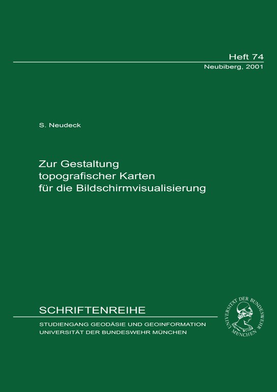
- NEUDECK, Stefan [2001]:
Präsentation kartografischer Darstellungen durch Datenprojektion
In: Proceedings of the 16th Electronic Displays Conference - NEUDECK, Stefan / BRUNNER, Kurt [2001]:
Anforderungen an die kartografische Visualisierung von Geodaten
In: STROBL, Josef / BLASCHKE, Thomas / GRIESEBNER, Gerald (Hrsg.): Angewandte Geographische Informationsverarbeitung XIII. Beiträge zum AGIT-Symposium Salzburg 2001. Wichmann Verlag, Heidelberg, S. 342-347
ISBN: 3-87907-361-9 - PENZKOFER, Markus [2001]:
Entzerrung und Georeferenzierung von Alpenvereinskarten
In: BRUNNER, Kurt / WELSCH, Walter (Hrsg.): Untersuchungen zur Georeferenzierung von Alpenvereinskarten. Wissenschaftliche Alpenvereinshefte, Heft 34, S. 19-59
ISBN: 3-928777-89-0
ISSN: 0084-0912 - PENZKOFER, Markus / BRUNNER, Kurt / FISCHER, Johannes / REINHARDT, Wolfgang [2001]:
Untersuchungen zur Genauigkeitsanalyse von Alpenvereinskarten
In: Zeitschrift für Vermessungswesen (zfv), 126. Jhrg., Heft 1, S. 5-10
ISSN: 0340-4560 Zusammenfassung
 - PRIDMORE, Tony P. / DARWISH, Ahmed / ELLIMAN, Dave [2001]:
Interpreting Line Drawing Images: A Common KADS Perspective
In: BLOSTEIN, Dorothea / KWON, Young-Bin (Hrsg.): Graphics Recognition Algorithms and Applications. 4th International Workshop, GREC 2001, Kingston, Ontario, Canada, September, 2001, Selected Papers. IAPR. Lectures Notes in Computer Science (LNCS), Vol. 2390. Springer Verlag, Berlin/Heidelberg/New York, S. 245-255
ISBN: 3-540-44066-6
ISSN: 0302-9743 Download
|
 |
- REINHARDT, Wolfgang [2001]:
Geodatenportal
In: BOLLMANN, Jürgen / LIPINSKI, Annette / KOCH, Wolf-Günther (Hrsg.): Lexikon der Kartographie und Geomatik, Band 1: A bis Karti. Spektrum, Akademischer Verlag, Heidelberg, S. 290
ISBN: 3-8274-1136-X - REINHARDT, Wolfgang [2001]:
Principles and Application of Geographic Information Systems and Internet/Intranet Technology
In: RTO/NATO (Hrsg.): New Information Processing Techniques for Military Systems (les Nouvelles techniques de traitement de l'information pour les systèmes militaires). Papers presented at the Information Systems Technology Panel (IST) Symposium held in Istanbul, Turkey, 9-11 October 2000. RTO Meeting Proceedings 49 (RTO-MP-049). North Atlantic Treaty Organization (NATO), Research and Technology Organization (RTO), Neuilly-sur-Seine, S. 10
ISBN: 92-837-1061-4 - REINHARDT, Wolfgang [2001]:
Zur Bedeutung der Internet-Technologie in Geoinformationssystemen
In: XI. Internationale Geodätische Woche Obergurgl 2001, Fachvorträge. Institutsmitteilungen des Instituts für Geodäsie der Leopold-Franzens Universität Innsbruck, Heft 19, S. 81-88 Download
 - REINHARDT, Wolfgang / JOOS, Gerhard [2001]:
Concept of a GIS and location based services for mountaineers
In: KONEČNÝ, Milan / FRIEDMANNOVA, Lucie / GOLAN, Jiri / KOLAR, Miroslav (Hrsg.): GI in Europe: Integrative, Interoperable, Interactive. 4th AGILE Conference on Geographic Science, April 19-21 2001, Brno, Czech Republic. Masaryk University, Brno, S. 198-202
ISBN: 80-210-2579-4 - REINHARDT, Wolfgang / SAYDA, Florian [2001]:
GIS and Location Based Services for Mountaineers -
Concept and Prototyp Realization
In: Beyond Information Infrastructure. Proceedings of the 2nd International Symposium on Digital Earth, Fredericton, New Brunswick, Canada - SAYDA, Florian / WITTMANN, Elmar [2001]:
VISPA - Virtual Sports Assistant
In: DEUTSCHE GESELLSCHAFT FÜR PHOTOGRAMMETRIE UND FERNERKUNDUNG E.V. / SEYFERT, Eckhardt (Hrsg.): Vorträge, 21. Wissenschaftlich-Technische Jahrestagung der DGPF, 4.-7. September 2001, "Dreiländertagung" in Konstanz. Photogrammetrie - Fernerkundung - Geoinformation: Geodaten schaffen Verbindungen. Publikationen der DGPF, Band 10, S. 215-222
ISBN: 0942-2870 Download
 - SHI, Wei / JOOS, Gerhard / REINHARDT, Wolfgang [2001]:
Management of Spatial Features with GML
In: KONEČNÝ, Milan / FRIEDMANNOVA, Lucie / GOLAN, Jiri / KOLAR, Miroslav (Hrsg.): GI in Europe: Integrative, Interoperable, Interactive. 4th AGILE Conference on Geographic Science, April 19-21 2001, Brno, Czech Republic. Masaryk University, Brno, S. 370-375
ISBN: 80-210-2579-4
 Publikationen 2002 Publikationen 2002 |
Publikationen 2000  |
 zurück zur Auswahl nach Autoren/Herausgebern und nach dem Jahr der Veröffentlichung